IMAGES TAKEN NEAR TO
Woodlands Rise, BRANDON, IP27 0NU
Introduction
This page details the photographs taken nearby to Woodlands Rise, IP27 0NU by members of the Geograph project.
The Geograph project started in 2005 with the aim of publishing, organising and preserving representative images for every square kilometre of Great Britain, Ireland and the Isle of Man.

There are currently over 7.5m images from over14,400 individuals and you can help contribute to the project by visiting https://www.geograph.org.uk
Image Map
Images are licensed for reuse under creativecommons.org/licenses/by-sa/2.0
Notes
- Clicking on the map will re-center to the selected point.
- The higher the marker number, the further away the image location is from the centre of the postcode.
Image Listing (10 Images Found)
Images are licensed for reuse under creativecommons.org/licenses/by-sa/2.0
Image
Details
Distance
3
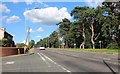
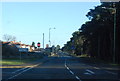
Mile End, Brandon
A1065 leaving Brandon.
Image: © Hugh Venables
Taken: 5 May 2012
0.11 miles
4

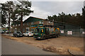
Industrial Estate, Brandon
On the edge of the town by the A1065.
Image: © Hugh Venables
Taken: 5 May 2012
0.12 miles
5
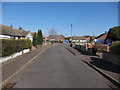
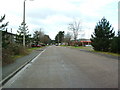
Norwood Road, Brandon Industrial Park
Image: © Hugh Venables
Taken: 13 Jan 2023
0.14 miles
7

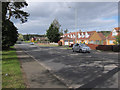
Mile End, Brandon
With the last of the houses along the A1065.
Image: © Hugh Venables
Taken: 5 May 2012
0.21 miles
8
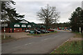
Travis Perkins, Brandon Industrial Park
Image: © Hugh Venables
Taken: 13 Jan 2023
0.21 miles
9
Industrial Units
Part of the industrial estate Brandon Suffolk.
Image: © Keith Evans
Taken: 6 Mar 2007
0.23 miles
10
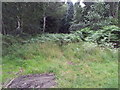
Start of a very overgrown track, Brandon Country Park
Image: © Helen Steed
Taken: 1 Aug 2012
0.24 miles