IMAGES TAKEN NEAR TO
Ickburgh, THETFORD, IP26 5JG
Introduction
This page details the photographs taken nearby to IP26 5JG by members of the Geograph project.
The Geograph project started in 2005 with the aim of publishing, organising and preserving representative images for every square kilometre of Great Britain, Ireland and the Isle of Man.

There are currently over 7.5m images from over14,400 individuals and you can help contribute to the project by visiting https://www.geograph.org.uk
Image Map
Images are licensed for reuse under creativecommons.org/licenses/by-sa/2.0
Notes
- Clicking on the map will re-center to the selected point.
- The higher the marker number, the further away the image location is from the centre of the postcode.
Image Listing (18 Images Found)
Images are licensed for reuse under creativecommons.org/licenses/by-sa/2.0
Image
Details
Distance
1
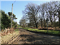
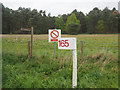
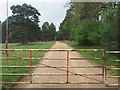
Ashburton Road starts to get a bit muddy
Image: © Adrian S Pye
Taken: 17 Feb 2015
0.02 miles
2
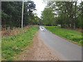
Looking Southeast along Ashburton Road
Image: © David Pashley
Taken: 25 Apr 2019
0.04 miles
3
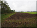
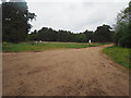
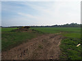
Arable farming
Looks like potatoes in headland of cereal crop
Image: © David Pashley
Taken: 25 Apr 2019
0.06 miles
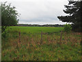
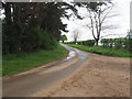
10
Looking towards Thetford Forest across arable field
Image: © David Pashley
Taken: 1 May 2019
0.14 miles