
IMAGES TAKEN NEAR TO
Mundford, THETFORD, IP26 5ED
Introduction
This page details the photographs taken nearby to IP26 5ED by members of the Geograph project.
The Geograph project started in 2005 with the aim of publishing, organising and preserving representative images for every square kilometre of Great Britain, Ireland and the Isle of Man.

There are currently over 7.5m images from over14,400 individuals and you can help contribute to the project by visiting https://www.geograph.org.uk
Image Map
Images are licensed for reuse under creativecommons.org/licenses/by-sa/2.0
Notes
- Clicking on the map will re-center to the selected point.
- The higher the marker number, the further away the image location is from the centre of the postcode.
Image Listing (74 Images Found)
Images are licensed for reuse under creativecommons.org/licenses/by-sa/2.0
Image
Details
Distance
1
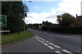
A134 Cranwich Road, Mundford
At the junction with St. Leonards Street
Image: © Geographer
Taken: 19 Sep 2017
0.01 miles
2
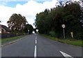
St. Leonards Street, Mundford
At the junction with the A134 Cranwich Road
Image: © Geographer
Taken: 19 Sep 2017
0.02 miles
3
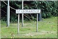
St. Leonards St sign
On the A134 Cranwich Road at the junction with St. Leonards Street
Image: © Geographer
Taken: 19 Sep 2017
0.02 miles
4
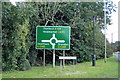
Roadsign & St. Leonards St sign
On the A134 Cranwich Road at the junction with St. Leonards Street
Image: © Geographer
Taken: 19 Sep 2017
0.02 miles
5
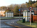
Cranwich Road, Mundford
Seen from St Leonards Street. Bus shelters are provided on both sides of the road but unfortunately Mundford's bus service is extremely sparse, especially for a village with a population of about 1,500.
Image: © Stephen McKay
Taken: 2 Jan 2017
0.03 miles
6
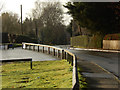
St Leonards Street, Mundford
In complete contrast to New Year's Day which was wet and miserable, the bank holiday Monday 2nd January dawned bright cold and clear. This was taken outside Mundford's village centre (village hall) at about 0930.
Image: © Stephen McKay
Taken: 2 Jan 2017
0.07 miles
7
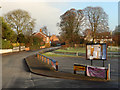
St Leonards Street, Mundford
The car park belongs to the village centre (village hall) where Black Dress Ladies' Boot Camp - fitness training for women - sessions are evidently a feature.
Image: © Stephen McKay
Taken: 2 Jan 2017
0.09 miles
8
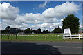
Plying Field off the A134 Cranwich Road
At the junction with Brecklands
Image: © Geographer
Taken: 19 Sep 2017
0.10 miles
9
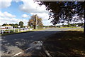
A134 Cranwich Road, Mundford
Looking towards the roundabout at the junction with Brecklands
Image: © Geographer
Taken: 19 Sep 2017
0.10 miles
10
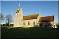
Mundford Church
St Leonard's Church is medieval but the south west tower is Victorian, built to replace a west tower that collapsed a century earlier. Unusually, the entrance porch is on the north side. The church has interior work by Sir Ninian Comper done in 1911-12. The building is grade II* listed.
Image: © Stephen McKay
Taken: 7 Jan 2018
0.14 miles