
IMAGES TAKEN NEAR TO
Hilborough, THETFORD, IP26 5DA
Introduction
This page details the photographs taken nearby to IP26 5DA by members of the Geograph project.
The Geograph project started in 2005 with the aim of publishing, organising and preserving representative images for every square kilometre of Great Britain, Ireland and the Isle of Man.

There are currently over 7.5m images from over14,400 individuals and you can help contribute to the project by visiting https://www.geograph.org.uk
Image Map
Images are licensed for reuse under creativecommons.org/licenses/by-sa/2.0
Notes
- Clicking on the map will re-center to the selected point.
- The higher the marker number, the further away the image location is from the centre of the postcode.
Image Listing (44 Images Found)
Images are licensed for reuse under creativecommons.org/licenses/by-sa/2.0
Image
Details
Distance
1

Narrow ride in conifer plantation
Looking towards the house at Ickburgh Fields.
Image: © Hugh Venables
Taken: 30 Mar 2018
0.02 miles
2

House in forest but on boundary of STANTA
STANTA
Image: © David Pashley
Taken: 27 Mar 2019
0.02 miles

4

Keep out sign
Actually still within the open access area.
Image: © Hugh Venables
Taken: 30 Mar 2018
0.07 miles
5

Birch and conifer planting
Young conifer sapling between lines of young birch trees.
Image: © Hugh Venables
Taken: 30 Mar 2018
0.08 miles


8
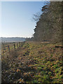
Track along STANTA boundary in Southerly ditection
STANTA stands for STANford Training Area situated roughly TL 8495.
The area was established in 1942 when a battle training area was required and a 'Nazi village' established. Military exercises were already taking place in the area; tanks had deployed to Thetford in the First World War. The complete takeover involved the complete evacuation of the villages of Buckenham Tofts, Langford, Stanford, Sturston, Tottington and West Tofts. The occupants of the houses were all rehoused in the belief that they would be allowed to return after the war. However the site was so valuable to the military that they have taken up permanent occupancy.
Image: © David Pashley
Taken: 27 Feb 2019
0.10 miles
9

Misty view of field in STANTA
STANTA stands for STANford Training Area situated roughly TL 8495.
The area was established in 1942 when a battle training area was required and a 'Nazi village' established. Military exercises were already taking place in the area; tanks had deployed to Thetford in the First World War. The complete takeover involved the complete evacuation of the villages of Buckenham Tofts, Langford, Stanford, Sturston, Tottington and West Tofts. The occupants of the houses were all rehoused in the belief that they would be allowed to return after the war. However the site was so valuable to the military that they have taken up permanent occupancy.
Image: © David Pashley
Taken: 27 Feb 2019
0.11 miles
