
IMAGES TAKEN NEAR TO
Hythe Road, THETFORD, IP26 5AH
Introduction
This page details the photographs taken nearby to Hythe Road, IP26 5AH by members of the Geograph project.
The Geograph project started in 2005 with the aim of publishing, organising and preserving representative images for every square kilometre of Great Britain, Ireland and the Isle of Man.

There are currently over 7.5m images from over14,400 individuals and you can help contribute to the project by visiting https://www.geograph.org.uk
Image Map
Images are licensed for reuse under creativecommons.org/licenses/by-sa/2.0
Notes
- Clicking on the map will re-center to the selected point.
- The higher the marker number, the further away the image location is from the centre of the postcode.
Image Listing (46 Images Found)
Images are licensed for reuse under creativecommons.org/licenses/by-sa/2.0
Image
Details
Distance

2
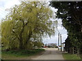
Approach to Church Farm, Foulden
The willow indicates the water saturation of the meadows hereabout.
Image: © Jonathan Billinger
Taken: 4 Apr 2007
0.07 miles
3
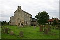
Foulden Church
All Saints Church in Foulden, Norfolk.
Image: © Bob Jones
Taken: 30 Jul 2005
0.11 miles
4
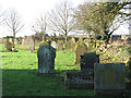
All Saints church - churchyard
See > http://www.geograph.org.uk/photo/1668079 for a view of the church.
Image: © Evelyn Simak
Taken: 17 Jan 2010
0.13 miles
5
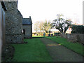
All Saints church - path through churchyard
See > http://www.geograph.org.uk/photo/1668079 for a view of the church.
Image: © Evelyn Simak
Taken: 17 Jan 2010
0.13 miles
6
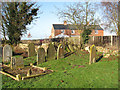
All Saints church - churchyard
See > http://www.geograph.org.uk/photo/1668079 for a view of the church.
Image: © Evelyn Simak
Taken: 17 Jan 2010
0.13 miles
7
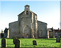
All Saints church
All Saints church > http://www.geograph.org.uk/photo/1668079 - http://www.geograph.org.uk/photo/1668096 dates from the 13th/14th centuries. Its square tower collapsed during the 18th century and was never rebuilt. The cusped tomb recess > http://www.geograph.org.uk/photo/1668083 in the exterior south aisle wall could be the tomb of the founder of the church, Sir John de Crake. Inside, the chancel > http://www.geograph.org.uk/photo/1668109 is almost completely 13th century. The benches with carved poppyheads and armrests > http://www.geograph.org.uk/photo/1668147 depicting birds and fantasy creatures date from the 15th century as does the baptismal font http://www.geograph.org.uk/photo/1668153. The box pews > http://www.geograph.org.uk/photo/1668134 in the aisles are Georgian (C18). Of the original C15 rood screen > http://www.geograph.org.uk/photo/1668102 the panels - they depict saints - are much overpainted and defaced.
Image: © Evelyn Simak
Taken: 17 Jan 2010
0.13 miles
8
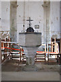
All Saints church - C15 baptismal font
All Saints church > http://www.geograph.org.uk/photo/1668079 - http://www.geograph.org.uk/photo/1668096 dates from the 13th/14th centuries. Its square tower collapsed during the 18th century and was never rebuilt. The cusped tomb recess > http://www.geograph.org.uk/photo/1668083 in the exterior south aisle wall could be the tomb of the founder of the church, Sir John de Crake. Inside, the chancel > http://www.geograph.org.uk/photo/1668109 is almost completely 13th century. The benches with carved poppyheads and armrests > http://www.geograph.org.uk/photo/1668147 depicting birds and fantasy creatures date from the 15th century as does the baptismal font. The box pews > http://www.geograph.org.uk/photo/1668134 in the aisles are Georgian (C18). Of the original C15 rood screen > http://www.geograph.org.uk/photo/1668102 the panels - they depict saints - are much overpainted and defaced.
Image: © Evelyn Simak
Taken: 17 Jan 2010
0.14 miles
9
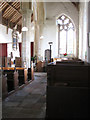
All Saints church - south aisle
All Saints church > http://www.geograph.org.uk/photo/1668079 - http://www.geograph.org.uk/photo/1668096 dates from the 13th/14th centuries. Its square tower collapsed during the 18th century and was never rebuilt. The cusped tomb recess > http://www.geograph.org.uk/photo/1668083 in the exterior south aisle wall could be the tomb of the founder of the church, Sir John de Crake. Inside, the chancel > http://www.geograph.org.uk/photo/1668109 is almost completely 13th century. The benches with carved poppyheads and armrests > http://www.geograph.org.uk/photo/1668147 depicting birds and fantasy creatures date from the 15th century as does the baptismal font http://www.geograph.org.uk/photo/1668153. The box pews > http://www.geograph.org.uk/photo/1668134 in the aisles are Georgian (C18). Of the original C15 rood screen > http://www.geograph.org.uk/photo/1668102 the panels - they depict saints - are much overpainted and defaced.
Image: © Evelyn Simak
Taken: 17 Jan 2010
0.14 miles
10
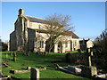
All Saints church
All Saints church > http://www.geograph.org.uk/photo/1668079 - http://www.geograph.org.uk/photo/1668096 dates from the 13th/14th centuries. Its square tower collapsed during the 18th century and was never rebuilt. The cusped tomb recess > http://www.geograph.org.uk/photo/1668083 in the exterior south aisle wall could be the tomb of the founder of the church, Sir John de Crake. Inside, the chancel > http://www.geograph.org.uk/photo/1668109 is almost completely 13th century. The benches with carved poppyheads and armrests > http://www.geograph.org.uk/photo/1668147 depicting birds and fantasy creatures date from the 15th century as does the baptismal font http://www.geograph.org.uk/photo/1668153. The box pews > http://www.geograph.org.uk/photo/1668134 in the aisles are Georgian (C18). Of the original C15 rood screen > http://www.geograph.org.uk/photo/1668102 the panels - they depict saints - are much overpainted and defaced.
Image: © Evelyn Simak
Taken: 17 Jan 2010
0.14 miles