IMAGES TAKEN NEAR TO
Cranworth, THETFORD, IP25 7SH

Introduction

This page details the photographs taken nearby to IP25 7SH by members of the Geograph project.

The Geograph project started in 2005 with the aim of publishing, organising and preserving representative images for every square kilometre of Great Britain, Ireland and the Isle of Man.

There are currently over 7.5m images from over14,400 individuals and you can help contribute to the project by visiting https://www.geograph.org.uk

Image Map


Images are licensed for reuse under creativecommons.org/licenses/by-sa/2.0
Notes
  • Clicking on the map will re-center to the selected point.
  • The higher the marker number, the further away the image location is from the centre of the postcode.

Image Listing (32 Images Found)

Images are licensed for reuse under creativecommons.org/licenses/by-sa/2.0
  • ...
Image
Details
Distance
1
Cranworth: Moor Lane
Image: © Michael Garlick Taken: 23 Oct 2022
0.06 miles
2
Woodrising Road through Cranworth
The view is northwesterly.
Image: © Evelyn Simak Taken: 25 Feb 2008
0.07 miles
3
Green by St Mary's Church, Cranworth
Image: © David Howard Taken: 19 Jul 2020
0.09 miles
4
Green near the church, Cranworth
Image: © JThomas Taken: 17 Jun 2017
0.09 miles
5
Cranworth village sign
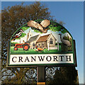
The sign features the church of St Mary, the old village stocks, which although they are still evident in the village they are no longer in use. The tractor represents the agricultural community and its history. There is a tawny owl, lesser spotted woodpecker, a brace of pheasants representing the wildlife, and most unusually a Sandhill crane. The villages name means 'Crane enclosure‘. https://www.geograph.org.uk/photo/6816149
Image: © Adrian S Pye Taken: 24 Apr 2021
0.09 miles
6
Cranworth village sign
The sign features the church of St Mary, the old village stocks, which although they are still evident in the village they are no longer in use. The tractor represents the agricultural community and its history. There is a tawny owl, great spotted woodpecker, a brace of pheasants representing the wildlife, and most unusually a Sandhill crane. The village's name means 'Crane enclosure'. https://www.geograph.org.uk/photo/6816150
Image: © Adrian S Pye Taken: 24 Apr 2021
0.09 miles
7
Cranworth War Memorial
The memorial bears twelve names relating to WW1 and four relating to WW2 on the left side. The WW2 names are Albert CLARKE, Geoffrey EBBAGE, George Graves and Robert Harris.
Image: © Adrian S Pye Taken: 4 Feb 2016
0.10 miles
8
Cranworth village hall
Image: © Hugh Venables Taken: 17 Apr 2016
0.10 miles
9
The headstone of Pilot Officer Cromie at Cranworth
Pilot Officer Noel George CROMIE (402516, RNZAF) was involved in an accident while towing a drogue in a live air firing exercise. He crashed in the sea while flying a Martinet of 11 OTU (Operational Training Unit). 11 OCU was stationed at RAF Westcott in Buckinghamshire along with its satellite station RAF Oakley. The reason he was buried here is not clear but it is possible that RAF Shipdham recovered the body and dealt with the interment.
Image: © Adrian S Pye Taken: 4 Feb 2016
0.11 miles
10
Rush hour in Cranston
Image: © Basher Eyre Taken: 15 Sep 2017
0.11 miles
  • ...