IMAGES TAKEN NEAR TO
The Green, THETFORD, IP25 7LA

Introduction

This page details the photographs taken nearby to The Green, IP25 7LA by members of the Geograph project.

The Geograph project started in 2005 with the aim of publishing, organising and preserving representative images for every square kilometre of Great Britain, Ireland and the Isle of Man.

There are currently over 7.5m images from over14,400 individuals and you can help contribute to the project by visiting https://www.geograph.org.uk

Image Map


Images are licensed for reuse under creativecommons.org/licenses/by-sa/2.0
Notes
  • Clicking on the map will re-center to the selected point.
  • The higher the marker number, the further away the image location is from the centre of the postcode.

Image Listing (47 Images Found)

Images are licensed for reuse under creativecommons.org/licenses/by-sa/2.0
  • ...
Image
Details
Distance
1
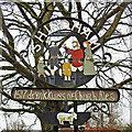
Shipdham village sign
The sign celebrates the village history of 1517 “The Drynkkings, sometimes known as the church ales, were social gatherings of this parish in the sixteenth century, when home-brewed ale was drunk in the church house, which stood in the churchyard. Followed by music and dancing on the village green.” The Drynnkings fete was started again in 2000 and always takes place every May Day. https://www.geograph.org.uk/photo/6804854
Image: © Adrian S Pye Taken: 8 Apr 2021
0.03 miles
2
Shipdham village sign
The sign celebrates the village history of 1517 “The Drynkkings, sometimes known as the church ales, were social gatherings of this parish in the sixteenth century, when home-brewed ale was drunk in the church house, which stood in the churchyard. Followed by music and dancing on the village green.” The Drynnkings fete was started again in 2000 and always takes place every May Day. https://www.geograph.org.uk/photo/6804855
Image: © Adrian S Pye Taken: 8 Apr 2021
0.03 miles
3
Village Sign
Village Sign in Shipdham, Norfolk
Image: © Craig Tuck Taken: 21 Feb 2009
0.03 miles
4
Church Close past All Saints Church
View in easterly direction from churchyard.
Image: © Evelyn Simak Taken: 28 Feb 2008
0.09 miles
5
Shipdham: aerial 2015
Image: © Chris Taken: 19 Sep 2015
0.09 miles
6
Ponders Garage, Shipdham
Image: © David Howard Taken: 19 Jul 2020
0.10 miles
7
All Saints, Shipdham, Norfolk
Image: © John Salmon Taken: 30 Aug 2001
0.10 miles
8
OS Benchmark
Recorded on Benchmark Database as 'Shipdham, All Saints Church'.
Image: © David Bremner Taken: 8 May 2023
0.11 miles
9
The church of All Saints - view west
The church and churchyard of All Saints are located in the centre of the village. The church of All Saints dates back to the 12th/13th century and has a distinctive cupola on the top of its tower; this was added in the 17th century. There were extensive restorations in 1845 and again during the 1880s and it is believed that the colourful floor tiles > Image were put in during that time. Also of interest is the tympanum (seen here): it is painted with the royal arms of Charles I. and once filled the chancel arch. Originally, the tympanum was combined with the decalogue boards that are now mounted on the wall of the north aisle. They are dated from 1630. All Saints church has two fonts, one of which dates from Norman times > Image For more information see: http://www.norfolkchurches.co.uk/shipdham/shipdham.htm
Image: © Evelyn Simak Taken: 28 Feb 2008
0.11 miles
10
All Saints Shipdham
The church of All Saints Shipdham, Norfolk for more info on the church see http://www.norfolkchurches.co.uk/shipdham/shipdham.htm
Image: © Keith Evans Taken: 24 Mar 2009
0.11 miles
  • ...