IMAGES TAKEN NEAR TO
Chequers Lane, THETFORD, IP25 7HH
Introduction
This page details the photographs taken nearby to Chequers Lane, IP25 7HH by members of the Geograph project.
The Geograph project started in 2005 with the aim of publishing, organising and preserving representative images for every square kilometre of Great Britain, Ireland and the Isle of Man.

There are currently over 7.5m images from over14,400 individuals and you can help contribute to the project by visiting https://www.geograph.org.uk
Image Map
Images are licensed for reuse under creativecommons.org/licenses/by-sa/2.0
Notes
- Clicking on the map will re-center to the selected point.
- The higher the marker number, the further away the image location is from the centre of the postcode.
Image Listing (20 Images Found)
Images are licensed for reuse under creativecommons.org/licenses/by-sa/2.0
Image
Details
Distance
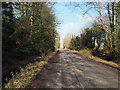
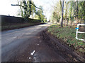
4

Chequers Lane, Saham Toney
Looking south east.
Image: © JThomas
Taken: 17 Jun 2017
0.08 miles
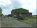
7
Fallow field with disused piggery in background
Image: © David Pashley
Taken: 9 Feb 2019
0.12 miles
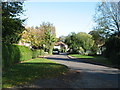
8
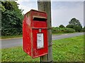
Post Box at Pages Lane, Saham Toney
Post Box IP25 3332.
Image: © David Bremner
Taken: 24 Jul 2021
0.12 miles