
IMAGES TAKEN NEAR TO
Necton Road, THETFORD, IP25 7EA
Introduction
This page details the photographs taken nearby to Necton Road, IP25 7EA by members of the Geograph project.
The Geograph project started in 2005 with the aim of publishing, organising and preserving representative images for every square kilometre of Great Britain, Ireland and the Isle of Man.

There are currently over 7.5m images from over14,400 individuals and you can help contribute to the project by visiting https://www.geograph.org.uk
Image Map
Images are licensed for reuse under creativecommons.org/licenses/by-sa/2.0
Notes
- Clicking on the map will re-center to the selected point.
- The higher the marker number, the further away the image location is from the centre of the postcode.
Image Listing (5 Images Found)
Images are licensed for reuse under creativecommons.org/licenses/by-sa/2.0
Image
Details
Distance
1
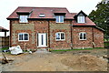
Holme Hale: One of two new detached houses
Image: © Michael Garlick
Taken: 30 Oct 2022
0.01 miles
3
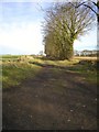
Black Drift trackway
Local track way used as farm track and by walkers. Travels ENE approaches Clay Pit Farm at Ivy Todd. This view from Hale Road junction between Holme Hale and Necton.
Image: © Alison Haines
Taken: 11 Jan 2009
0.12 miles
4
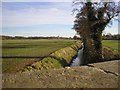
River Wissey from Bridge at Hale Road
Bridge marks the boundary of Hale Road Necton and Cook Road Holme Hale.
The fields look across to Grid Square 9008 east of this location.
River Wissey flows west.
Image: © Alison Haines
Taken: 11 Jan 2009
0.14 miles
5
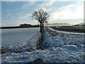
Snow in Necton
View from Rams Lane, looking towards Black Drift.
Image: © Bob Westfield
Taken: 18 Jan 2004
0.23 miles