IMAGES TAKEN NEAR TO
Granary Fields, THETFORD, IP25 7BN
Introduction
This page details the photographs taken nearby to Granary Fields, IP25 7BN by members of the Geograph project.
The Geograph project started in 2005 with the aim of publishing, organising and preserving representative images for every square kilometre of Great Britain, Ireland and the Isle of Man.

There are currently over 7.5m images from over14,400 individuals and you can help contribute to the project by visiting https://www.geograph.org.uk
Image Map
Images are licensed for reuse under creativecommons.org/licenses/by-sa/2.0
Notes
- Clicking on the map will re-center to the selected point.
- The higher the marker number, the further away the image location is from the centre of the postcode.
Image Listing (16 Images Found)
Images are licensed for reuse under creativecommons.org/licenses/by-sa/2.0
Image
Details
Distance
1
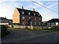
That's A Big House
A house for sale in the Granary Fields development, North of Ashill.
Image: © Roger Gilbertson
Taken: 3 Nov 2006
0.05 miles
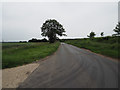
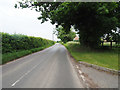
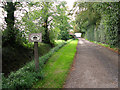
2
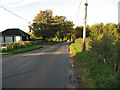
The Road To Holme Hale
From Ashill.
Image: © Roger Gilbertson
Taken: 3 Nov 2006
0.05 miles
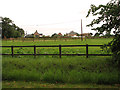
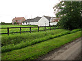
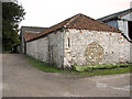
3
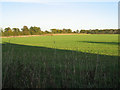
A Field Near Bury's Hall
North of Ashill.
Image: © Roger Gilbertson
Taken: 3 Nov 2006
0.05 miles