IMAGES TAKEN NEAR TO
Ashill, THETFORD, IP25 7BB

Introduction

This page details the photographs taken nearby to IP25 7BB by members of the Geograph project.

The Geograph project started in 2005 with the aim of publishing, organising and preserving representative images for every square kilometre of Great Britain, Ireland and the Isle of Man.

There are currently over 7.5m images from over14,400 individuals and you can help contribute to the project by visiting https://www.geograph.org.uk

Image Map


Images are licensed for reuse under creativecommons.org/licenses/by-sa/2.0
Notes
  • Clicking on the map will re-center to the selected point.
  • The higher the marker number, the further away the image location is from the centre of the postcode.

Image Listing (12 Images Found)

Images are licensed for reuse under creativecommons.org/licenses/by-sa/2.0
Image
Details
Distance
1
Trade entrance road to Panworth Hall Farm
Image: © David Pashley Taken: 10 Apr 2019
0.17 miles
2
Looking back to Ashill
Image: © David Pashley Taken: 10 Apr 2019
0.19 miles
3
Sign at entrance to Panworth Hall Farm
Image: © David Pashley Taken: 10 Apr 2019
0.19 miles
4
Looking East down country lane
Image: © David Pashley Taken: 10 Apr 2019
0.22 miles
5
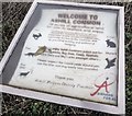
Ashill Common sign
Information sign for Ashill Common.
Image: © David Pashley Taken: 31 Dec 2018
0.23 miles
6
A Dog-Walker's Delight
The entrance to Ashill Common from the parking area. Dog-walking appeared to be the only activity.
Image: © Roger Gilbertson Taken: 4 Nov 2006
0.23 miles
7
The Lane Beside The Common
The lane going East from the car park at Ashill Common.
Image: © Roger Gilbertson Taken: 4 Nov 2006
0.23 miles
8
Ashill Common
Still used as common land but, now, more for leisure than for economic purposes.
Image: © Roger Gilbertson Taken: 4 Nov 2006
0.23 miles
9
Commonplace
The car park at Ashill Common.
Image: © Roger Gilbertson Taken: 4 Nov 2006
0.23 miles
10
Boundary of Ashill Common
Ashill Common area of grassland managed for wildlife for walking and very popular for dog walking.
Image: © David Pashley Taken: 15 Feb 2019
0.23 miles