IMAGES TAKEN NEAR TO
Bramley Lane, THETFORD, IP25 6YZ

Introduction

This page details the photographs taken nearby to Bramley Lane, IP25 6YZ by members of the Geograph project.

The Geograph project started in 2005 with the aim of publishing, organising and preserving representative images for every square kilometre of Great Britain, Ireland and the Isle of Man.

There are currently over 7.5m images from over14,400 individuals and you can help contribute to the project by visiting https://www.geograph.org.uk

Image Map


Images are licensed for reuse under creativecommons.org/licenses/by-sa/2.0
Notes
  • Clicking on the map will re-center to the selected point.
  • The higher the marker number, the further away the image location is from the centre of the postcode.

Image Listing (39 Images Found)

Images are licensed for reuse under creativecommons.org/licenses/by-sa/2.0
  • ...
Image
Details
Distance
1
Industrial estate
Image: © David Pashley Taken: 24 Jun 2019
0.05 miles
2
North on Church Road
Image: © David Pashley Taken: 24 Jun 2019
0.07 miles
3
Pargeting, Griston
This is a modern example of traditional relief ornamentation in lime plaster used on timber framed buildings, most commonly in Suffolk and Essex. http://www.buildingconservation.com/articles/pargeting/pargeting.htm
Image: © Lisa Wild Taken: 18 Sep 2007
0.08 miles
4
Church Road
View south along Church Road, past the church of St Peter and St Paul.
Image: © Evelyn Simak Taken: 23 Feb 2008
0.11 miles
5
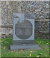
Memorial to 3d Strategic Air Depot, USAAF
RAF Watton and the village of Griston were closely entwined during WW2. The Airbase was used by the United States Army Air Force's Eighth Air Force as a major overhaul depot for Consolidated B-24 Liberator bombers and as a weather reconnaissance base 1943 - 1945
Image: © Adrian S Pye Taken: 11 Oct 2018
0.13 miles
6
Griston War Memorial
The WW1 memorial bears six names and the WW2 memorial below, bears two.
Image: © Adrian S Pye Taken: 11 Oct 2018
0.13 miles
7
Griston Church Tower
Image: © David Pashley Taken: 24 Jun 2019
0.13 miles
8
Looking South across Churchyard to Griston Church
Image: © David Pashley Taken: 24 Jun 2019
0.14 miles
9
The church of St Peter & St Paul - churchyard
The church is surrounded by a large churchyard. A path lined by ancient lime trees leads to the north doorway which, sadly, is firmly locked (the porch is secured with a padlock). For more information see: http://www.norfolkchurches.co.uk/griston/griston.htm A memorial dedicated to the American servicemen of the 3rd Strategic Air Depot, who were stationed at Station 505 was erected in the churchyard and inside the church hangs an American flag given by the servicemen who used the church whilst stationed here during the Second World War.
Image: © Evelyn Simak Taken: 23 Feb 2008
0.14 miles
10
South on Church Road
Image: © David Pashley Taken: 24 Jun 2019
0.15 miles
  • ...