
IMAGES TAKEN NEAR TO
Shipdham Road, THETFORD, IP25 6ST
Introduction
This page details the photographs taken nearby to Shipdham Road, IP25 6ST by members of the Geograph project.
The Geograph project started in 2005 with the aim of publishing, organising and preserving representative images for every square kilometre of Great Britain, Ireland and the Isle of Man.

There are currently over 7.5m images from over14,400 individuals and you can help contribute to the project by visiting https://www.geograph.org.uk
Image Map
Images are licensed for reuse under creativecommons.org/licenses/by-sa/2.0
Notes
- Clicking on the map will re-center to the selected point.
- The higher the marker number, the further away the image location is from the centre of the postcode.
Image Listing (79 Images Found)
Images are licensed for reuse under creativecommons.org/licenses/by-sa/2.0
Image
Details
Distance
1
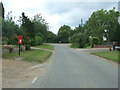
Shipdham Road, Carbrooke
Showing position of Postbox No. IP25 3421.
See Image] for postbox.
Image: © JThomas
Taken: 17 Jun 2017
0.06 miles
2
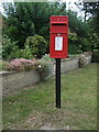
Elizabeth II postbox on Shipdham Road, Carbrooke
Postbox No. IP25 3421.
See Image] for context.
Image: © JThomas
Taken: 17 Jun 2017
0.06 miles
3
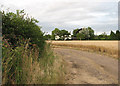
Track leading west
This track turns off Shipdham Road and leads first in westerly, later in northerly direction, past Carbrooke Fen and Fen Farm, and to Brakehill Lodge Farm beyond. The view was taken in easterly direction; the house seen in mid-distance backs onto Shipdham Road. See > http://www.geograph.org.uk/photo/907219 for a view of this track further to the northwest.
Image: © Evelyn Simak
Taken: 1 Aug 2008
0.11 miles
4
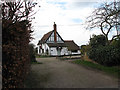
House beside Church Street
This property borders the village green; for a different view see Image
Image: © Evelyn Simak
Taken: 1 Mar 2008
0.12 miles
7
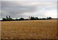
A large barley field
The view was taken from a track leading past Carbrooke Fen and Fen Farm and to Brakehill Lodge Farm beyond. In the distance the church of SS Peter and Paul in Carbrooke can be seen: being situated on the highest point in the village its high tower can be seen for miles.
Image: © Evelyn Simak
Taken: 1 Aug 2008
0.13 miles
9
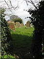
One way into the churchyard
Of > Image leads through a gap in the hedge beside Church Road.
Image: © Evelyn Simak
Taken: 1 Mar 2008
0.14 miles
10
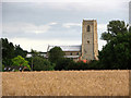
The church of SS Peter & Paul
And rooftops of surrounding houses in the village of Carbrooke, viewed across a vast field of barley waiting to be harvested.
The church of St Peter & St Paul stands on an elevation in the village of Carbrooke (its 99 feet/30 metres high tower can be seen for many miles), adjacent to a pasture where the Carbrooke Commandery once stood Image; here the Knights Hospitallers collected alms for pilgrims to Jerusalem and the military duties that arose from their care and shelter. The church houses East Anglia's oldest identifiable coffin slabs, both bearing the cross marks of the Knights Templar, and presumed to mark the graves of the widow of Roger, Earl of Clare, who founded the Commandery in about 1193, and their son James > Image The north porch > Image has been blocked; the entrance into the church leads through the ogee-arched south doorway > Image The hammerbeam roof with figures of angels dates from the 15th century as does the (restored) rood screen > Image and the carved bench ends at the west end of the nave > Image A medieval altar stone with five consecration crosses, one in each corner and one in its centre, forms the altar in the north aisle > Image A memorial commemorating a former rector's daughter (died in 1932) can be seen on the east wall > Image The church is kept locked. For more information see: http://www.norfolkchurches.co.uk/carbrooke/carbrooke.htm
Image: © Evelyn Simak
Taken: 1 Aug 2008
0.14 miles