IMAGES TAKEN NEAR TO
Watton, THETFORD, IP25 6RA
Introduction
This page details the photographs taken nearby to IP25 6RA by members of the Geograph project.
The Geograph project started in 2005 with the aim of publishing, organising and preserving representative images for every square kilometre of Great Britain, Ireland and the Isle of Man.

There are currently over 7.5m images from over14,400 individuals and you can help contribute to the project by visiting https://www.geograph.org.uk
Image Map
Images are licensed for reuse under creativecommons.org/licenses/by-sa/2.0
Notes
- Clicking on the map will re-center to the selected point.
- The higher the marker number, the further away the image location is from the centre of the postcode.
Image Listing (23 Images Found)
Images are licensed for reuse under creativecommons.org/licenses/by-sa/2.0
Image
Details
Distance
1
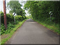
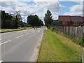
End of speed restriction on minor road to Carbrooke
Image: © David Pashley
Taken: 27 May 2019
0.10 miles
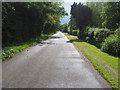
2
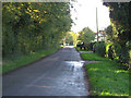
Caudlesprings Road
From Watton Green towards Watton.
Image: © Roger Gilbertson
Taken: 3 Nov 2006
0.12 miles
3
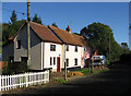
Det Lille Hus
"Det Lille Hus" is the name of the pink cottage at the far end of the terrace on Caudle Springs Road.
Image: © Roger Gilbertson
Taken: 3 Nov 2006
0.12 miles
4
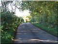
Caudlesprings Road
To Caudlesprings and Carbrooke.
Image: © Roger Gilbertson
Taken: 3 Nov 2006
0.12 miles
5
Looking towards Watton on minor road to Carbrooke
Image: © David Pashley
Taken: 27 May 2019
0.15 miles
6
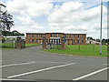
Ex RAF Watton former Airmen's Mess
Now trading as Mr Read's Carpet Centre.
Image: © Adrian S Pye
Taken: 6 Jul 2016
0.17 miles
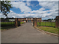
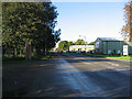
8
Entrance to Akrotiri Square
Former MOD properties
Image: © David Pashley
Taken: 7 Jul 2019
0.18 miles
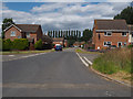
10
Entering Watton
On the B1108 from Hingham.
Image: © Roger Gilbertson
Taken: 3 Nov 2006
0.20 miles