IMAGES TAKEN NEAR TO
Home Farm Lane, THETFORD, IP25 6QS
Introduction
This page details the photographs taken nearby to Home Farm Lane, IP25 6QS by members of the Geograph project.
The Geograph project started in 2005 with the aim of publishing, organising and preserving representative images for every square kilometre of Great Britain, Ireland and the Isle of Man.

There are currently over 7.5m images from over14,400 individuals and you can help contribute to the project by visiting https://www.geograph.org.uk
Image Map
Images are licensed for reuse under creativecommons.org/licenses/by-sa/2.0
Notes
- Clicking on the map will re-center to the selected point.
- The higher the marker number, the further away the image location is from the centre of the postcode.
Image Listing (31 Images Found)
Images are licensed for reuse under creativecommons.org/licenses/by-sa/2.0
Image
Details
Distance
3
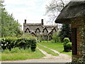
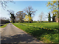
Thatched cottage at Merton Green
The building on the right is the bus shelter
Image: © Adrian S Pye
Taken: 22 May 2019
0.08 miles
5
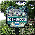
Merton village sign
The sign illustrates a pink thatched cottage with trees and bushes. https://www.geograph.org.uk/photo/6160316
The unusual bus shelter on the green, which was erected by public subscription and local tradesmen for the benefit of the people in 1977, for Queens Jubilee, https://www.geograph.org.uk/photo/6160322 and a cock pheasant struts his stuff across the lawn. Below the name ears of wheat support the crest of Lord Walsingham who resides in the parish.
https://www.geograph.org.uk/photo/6160318
Image: © Adrian S Pye
Taken: 22 May 2019
0.09 miles
6
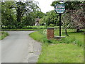
Merton village sign and postbox
There are two facets to the village sign
https://www.geograph.org.uk/photo/6657331
https://www.geograph.org.uk/photo/2417140
Image: © Adrian S Pye
Taken: 22 May 2019
0.09 miles
8
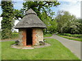
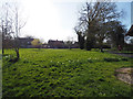
Bus shelter on Merton Green
Crow's Road in the background, which leads north to Watton.
Image: © Adrian S Pye
Taken: 22 May 2019
0.10 miles
9
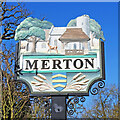
Merton village sign (west face)
This side of the sign shows the church, lych-gate and a deer. Below the name, ears of wheat support the arms of Grey, Barons Walsingham and the crest of Monsr Thomas Cornerde (I think). On the other side https://www.geograph.org.uk/photo/6657331 the unusual bus shelter on the green, which was erected by public subscription and local tradesmen for the benefit of the people in 1977, for the Queens Jubilee, and a cock pheasant struts his stuff across the lawn.
Image: © Adrian S Pye
Taken: 29 Mar 2021
0.11 miles