
IMAGES TAKEN NEAR TO
Muriel Way, THETFORD, IP25 6PB
Introduction
This page details the photographs taken nearby to Muriel Way, IP25 6PB by members of the Geograph project.
The Geograph project started in 2005 with the aim of publishing, organising and preserving representative images for every square kilometre of Great Britain, Ireland and the Isle of Man.

There are currently over 7.5m images from over14,400 individuals and you can help contribute to the project by visiting https://www.geograph.org.uk
Image Map
Images are licensed for reuse under creativecommons.org/licenses/by-sa/2.0
Notes
- Clicking on the map will re-center to the selected point.
- The higher the marker number, the further away the image location is from the centre of the postcode.
Image Listing (85 Images Found)
Images are licensed for reuse under creativecommons.org/licenses/by-sa/2.0
Image
Details
Distance
1
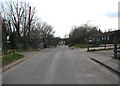
Looking south along Church Street
Through Carbrooke
Image: © Evelyn Simak
Taken: 1 Mar 2008
0.09 miles
2
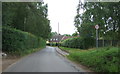
Bridge Street, Carbrooke
Looking north east.
Image: © JThomas
Taken: 17 Jun 2017
0.10 miles
4
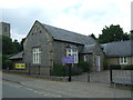
St Peter and St Paul School, Carbrooke
On Church Street.
Image: © JThomas
Taken: 17 Jun 2017
0.12 miles
6
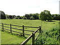
Earthwork; site of an ancient Preceptory
In the time of Henry II, Maud, countess of Clare, gave the church of St. Peter, Great Carbrooke, and of St. John Baptist, Little Carbrooke, to the Knights Hospitallers.
Image: © Adrian S Pye
Taken: 22 May 2019
0.12 miles
7
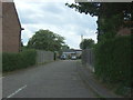
Residential close off Church Street, Carbrooke
Image: © JThomas
Taken: 17 Jun 2017
0.13 miles
8
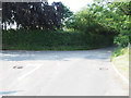
Junction of Drury Lane and Summer Lane
Image: © David Pashley
Taken: 12 Jul 2019
0.14 miles
9
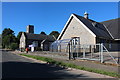
St Peter & St Paul primary school, Carbrooke
Image: © David Howard
Taken: 19 Jul 2020
0.14 miles
10
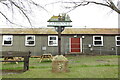
Carbrooke village sign
The sign depicts the Knights Hospitallers and the Commandery of St John of Jerusalem, which was sited in the village between 1173 and 1540, before the dissolution of the monasteries by Henry VIII. Some remains are extant in the meadows behind the church. https://www.geograph.org.uk/photo/6803847
The building in the background is the village hall. https://www.geograph.org.uk/photo/6803857
Image: © Adrian S Pye
Taken: 8 Apr 2021
0.15 miles