IMAGES TAKEN NEAR TO
Little Cressingham, THETFORD, IP25 6LY
Introduction
This page details the photographs taken nearby to IP25 6LY by members of the Geograph project.
The Geograph project started in 2005 with the aim of publishing, organising and preserving representative images for every square kilometre of Great Britain, Ireland and the Isle of Man.

There are currently over 7.5m images from over14,400 individuals and you can help contribute to the project by visiting https://www.geograph.org.uk
Image Map
Images are licensed for reuse under creativecommons.org/licenses/by-sa/2.0
Notes
- Clicking on the map will re-center to the selected point.
- The higher the marker number, the further away the image location is from the centre of the postcode.
Image Listing (9 Images Found)
Images are licensed for reuse under creativecommons.org/licenses/by-sa/2.0
Image
Details
Distance
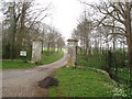
1
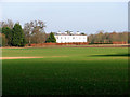
Clermont Lodge, Little Cressingham
Clermont Lodge was built in the 1770s for the Earl of Clermont as a shooting box and extended by William Pilkington for his nephew in 1812. The lodge was derelict and threatened by demolition in 1972 when Mr. Philip Jones, a painter who trained at the Slade under William Coldstream, bought and restored it.
Image: © Evelyn Simak
Taken: 31 Jan 2011
0.09 miles
2
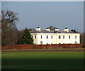
Clermont Lodge, Little Cressingham
Clermont Lodge was built in the 1770s for the Earl of Clermont as a shooting box and extended by William Pilkington for his nephew in 1812. The lodge was derelict and threatened by demolition in 1972 when Mr. Philip Jones, a painter who trained at the Slade under William Coldstream, bought and restored it.
Image: © Evelyn Simak
Taken: 31 Jan 2011
0.09 miles
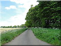
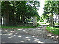
5
Entrance to Clermont Hall
The distant Clermont Hall is on the edge of the Ministry of Defence training area which stretches across a wide area of Breckland.
Image: © David Williams
Taken: 13 Apr 2007
0.21 miles
6
Entrance To Clermont House
Entrance to Clermont House near to Threxton Hill, Norfolk.
Image: © Keith Evans
Taken: 14 Jun 2009
0.21 miles
7
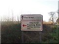
MOD sign
Directional sign for the military.
Image: © David Pashley
Taken: 12 Dec 2018
0.22 miles
8
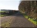
Road to The Arms
Almost hidden MOD sign banning military vehicles from the road to The Arms.
Image: © David Pashley
Taken: 12 Dec 2018
0.22 miles
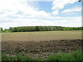
9
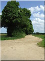
Track To Threxton House
Track to Threxton House near to The Arms, Norfolk.
Image: © Keith Evans
Taken: 14 Jun 2009
0.23 miles