IMAGES TAKEN NEAR TO
Brandon Road, THETFORD, IP25 6LR
Introduction
This page details the photographs taken nearby to Brandon Road, IP25 6LR by members of the Geograph project.
The Geograph project started in 2005 with the aim of publishing, organising and preserving representative images for every square kilometre of Great Britain, Ireland and the Isle of Man.

There are currently over 7.5m images from over14,400 individuals and you can help contribute to the project by visiting https://www.geograph.org.uk
Image Map
Images are licensed for reuse under creativecommons.org/licenses/by-sa/2.0
Notes
- Clicking on the map will re-center to the selected point.
- The higher the marker number, the further away the image location is from the centre of the postcode.
Image Listing (20 Images Found)
Images are licensed for reuse under creativecommons.org/licenses/by-sa/2.0
Image
Details
Distance
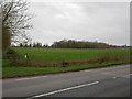
1
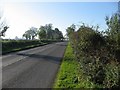
The B1108
On the way from Watton to Little Cressingham.
Image: © Roger Gilbertson
Taken: 4 Nov 2006
0.07 miles
2
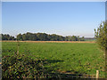
Breckland District
A typical view in this mainly rural District.
Image: © Roger Gilbertson
Taken: 4 Nov 2006
0.07 miles
3
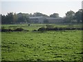
Barns In Breckland
Close to the B1108.
Image: © Roger Gilbertson
Taken: 4 Nov 2006
0.07 miles
4
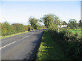
On The Way To Watton
By the B1108 from Little Cressingham.
Image: © Roger Gilbertson
Taken: 4 Nov 2006
0.07 miles
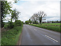
9
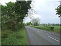
Brandon Road (B1108) towards Watton
Looking north east.
Image: © JThomas
Taken: 13 May 2017
0.14 miles
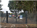
10
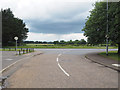
Estate junction with B1108 Watton road
Image: © David Pashley
Taken: 14 Jun 2019
0.14 miles