IMAGES TAKEN NEAR TO
Nelson Court, THETFORD, IP25 6EN

Introduction

This page details the photographs taken nearby to Nelson Court, IP25 6EN by members of the Geograph project.

The Geograph project started in 2005 with the aim of publishing, organising and preserving representative images for every square kilometre of Great Britain, Ireland and the Isle of Man.

There are currently over 7.5m images from over14,400 individuals and you can help contribute to the project by visiting https://www.geograph.org.uk

Image Map


Images are licensed for reuse under creativecommons.org/licenses/by-sa/2.0
Notes
  • Clicking on the map will re-center to the selected point.
  • The higher the marker number, the further away the image location is from the centre of the postcode.

Image Listing (133 Images Found)

Images are licensed for reuse under creativecommons.org/licenses/by-sa/2.0
  • ...
Image
Details
Distance
1
View along A1075 towards Watton
Looking towards traffic lights in Watton.
Image: © David Pashley Taken: 1 Jan 2019
0.11 miles
2
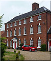
Quinton House, Watton
A surprisingly substantial and urbane Georgian house for a small town. Seven bays and three storeys, keystoned windows and a pedimented doorcase. A Watton Society plaque records that "it was built in 1720 for Edward Harvey, a local wool merchant. In more recent times it has been a doctor's residence and surgery before becoming a residential home". In fact, it was probably built nearer 1750. Grade II listed.
Image: © Stephen Richards Taken: 19 Jun 2013
0.11 miles
3
Watton Town Hall
Viewed from the south.
Image: © Peter Wood Taken: 9 Nov 2014
0.11 miles
4
Ordnance Survey Flush Bracket S0264
This can be found on the wall of The Town Hall in Watton. For more detail see : http://www.bench-marks.org.uk/bm10731
Image: © Peter Wood Taken: 9 Nov 2014
0.11 miles
5
Watton Town Hall
Beside the Kings Arms public house.
Image: © JThomas Taken: 13 May 2017
0.11 miles
6
The Kings Arms public house, Watton
On Middle Street.
Image: © JThomas Taken: 13 May 2017
0.11 miles
7
Sign for the Kings Arms public house, Watton
Image: © JThomas Taken: 13 May 2017
0.11 miles
8
Middle Street, Watton
Middle street is a short street running west from Dereham Road parallel with High Street.
Image: © Stephen McKay Taken: 8 Feb 2015
0.11 miles
9
Watton Clock Tower
Built in 1679 by Christopher Hey, a mercer of the town. The lower part used to be the town lock-up and until recently was the tourist information office. See Image
Image: © Bob Jones Taken: 30 May 2008
0.12 miles
10
Former town lock-up, Watton
This is the lower section of Watton Clock Tower; see Image This used to be the local Tourist Information Office, but the 'i' sign has been removed since Image was taken in August 2005.
Image: © Bob Jones Taken: 30 May 2008
0.12 miles
  • ...