
IMAGES TAKEN NEAR TO
Goffe Close, THETFORD, IP25 6EF
Introduction
This page details the photographs taken nearby to Goffe Close, IP25 6EF by members of the Geograph project.
The Geograph project started in 2005 with the aim of publishing, organising and preserving representative images for every square kilometre of Great Britain, Ireland and the Isle of Man.

There are currently over 7.5m images from over14,400 individuals and you can help contribute to the project by visiting https://www.geograph.org.uk
Image Map
Images are licensed for reuse under creativecommons.org/licenses/by-sa/2.0
Notes
- Clicking on the map will re-center to the selected point.
- The higher the marker number, the further away the image location is from the centre of the postcode.
Image Listing (109 Images Found)
Images are licensed for reuse under creativecommons.org/licenses/by-sa/2.0
Image
Details
Distance
3
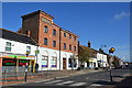
Former Brewery
Building formerly Watton Brewery on the High Street Watton, Norfolk. Production ceased in about 1912 after it had been taken over by Morgans Brewery of Norwich.
Image: © Keith Evans
Taken: 4 Nov 2014
0.11 miles
4
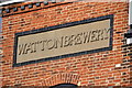
Watton Brewery Sign
Old name on former brewery building at Watton, Norfolk for view of the building see http://www.geograph.org.uk/photo/4308213
Image: © Keith Evans
Taken: 4 Nov 2014
0.11 miles
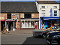
6
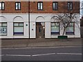
Recruitment shop
Recruitment shop for care workers.
Image: © David Pashley
Taken: 1 Jan 2019
0.11 miles
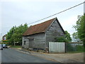
8
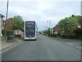
Bus top on Brandon Road (B1108), Watton
Looking east.
Image: © JThomas
Taken: 13 May 2017
0.12 miles
10
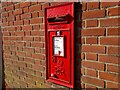
Post Box, Watton, Norfolk
IP25 3326. Royal Mail list this box as 'IP25 Harvey Street Watton Thetford'.
Image: © David Bremner
Taken: 28 Oct 2021
0.12 miles