IMAGES TAKEN NEAR TO
Burrell Way, THETFORD, IP24 3RA
Introduction
This page details the photographs taken nearby to Burrell Way, IP24 3RA by members of the Geograph project.
The Geograph project started in 2005 with the aim of publishing, organising and preserving representative images for every square kilometre of Great Britain, Ireland and the Isle of Man.

There are currently over 7.5m images from over14,400 individuals and you can help contribute to the project by visiting https://www.geograph.org.uk
Image Map
Images are licensed for reuse under creativecommons.org/licenses/by-sa/2.0
Notes
- Clicking on the map will re-center to the selected point.
- The higher the marker number, the further away the image location is from the centre of the postcode.
Image Listing (29 Images Found)
Images are licensed for reuse under creativecommons.org/licenses/by-sa/2.0
Image
Details
Distance
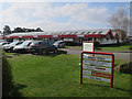
1
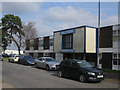
Multiyork factory and head office, Thetford
Stephenson House on Stephenson Way.
Image: © Hugh Venables
Taken: 24 Mar 2017
0.05 miles
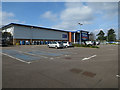
2
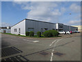
Precision Refrigeration
On the large industrial estate on the west side of Thetford.
Image: © Hugh Venables
Taken: 24 Mar 2017
0.06 miles
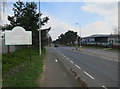
3
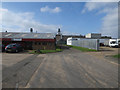
Stephenson Way
Part of the large industrial estate on the west side of Thetford.
Image: © Hugh Venables
Taken: 24 Mar 2017
0.07 miles
5
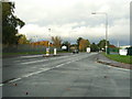
London Road thetford
London road Thetford, Norfolk as seen from Caxton Way Industrial estate entrance.
Image: © Keith Evans
Taken: 24 Oct 2009
0.12 miles
9
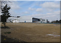
Cleared area in industrial estate
Recently demolished site off Caxton Way.
Image: © Hugh Venables
Taken: 24 Mar 2017
0.14 miles
10
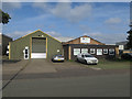
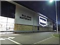
Cushion Manufacturing Supplies, Thetford
Image: © Hugh Venables
Taken: 24 Mar 2017
0.14 miles