
IMAGES TAKEN NEAR TO
Kingsway, THETFORD, IP24 3DY
Introduction
This page details the photographs taken nearby to Kingsway, IP24 3DY by members of the Geograph project.
The Geograph project started in 2005 with the aim of publishing, organising and preserving representative images for every square kilometre of Great Britain, Ireland and the Isle of Man.

There are currently over 7.5m images from over14,400 individuals and you can help contribute to the project by visiting https://www.geograph.org.uk
Image Map
Images are licensed for reuse under creativecommons.org/licenses/by-sa/2.0
Notes
- Clicking on the map will re-center to the selected point.
- The higher the marker number, the further away the image location is from the centre of the postcode.
Image Listing (15 Images Found)
Images are licensed for reuse under creativecommons.org/licenses/by-sa/2.0
Image
Details
Distance
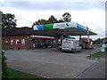
2
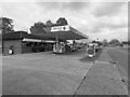
Study of a Gasoline Station
Harvest Energy, Thetford.
This photograph is part of a series taken in homage to the American artist Ed Ruscha's 1963 publication of 'Twentysix Gasoline Stations'.
More properly known as filling stations in the UK, I am attempting to photograph as many as possible to mark the sixty year anniversary.
Image: © David Bremner
Taken: 9 May 2023
0.06 miles
3
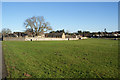
Barnham Cross Common
The part nearest the town of Thetford is the most manicured. I presume the long wall originated with the former nunnery.
Image: © Bill Boaden
Taken: 28 Dec 2013
0.09 miles
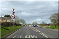
5
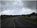
And that was it for the day
Note the imminent rain, which dogged up all the way down the St Edmund's Way from this point in Nuns' Bridge Road. It just got heavier and HEAVIER!!!
Image: © Basher Eyre
Taken: 17 Sep 2017
0.16 miles
6
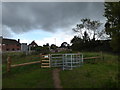
Road and path entrance in Nuns' Bridge Road
Image: © Basher Eyre
Taken: 17 Sep 2017
0.16 miles
7
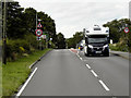
Bury Road (A134) Approaching Thetford from the South
Image: © David Dixon
Taken: 6 Aug 2015
0.16 miles
9
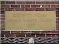
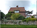
Nunnery Drive: guess who lives here?
Well did. A lot of these have been sold off, I'm afraid
Image: © Basher Eyre
Taken: 17 Sep 2017
0.19 miles
10
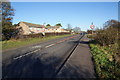
Bury Road on the edge of Thetford
The road from Bury St Edmunds crosses Barnham Cross Common on its way into Thetford. These are the first houses of the town.
Image: © Bill Boaden
Taken: 28 Dec 2013
0.19 miles