
IMAGES TAKEN NEAR TO
Old Bury Road, THETFORD, IP24 3AL
Introduction
This page details the photographs taken nearby to Old Bury Road, IP24 3AL by members of the Geograph project.
The Geograph project started in 2005 with the aim of publishing, organising and preserving representative images for every square kilometre of Great Britain, Ireland and the Isle of Man.

There are currently over 7.5m images from over14,400 individuals and you can help contribute to the project by visiting https://www.geograph.org.uk
Image Map
Images are licensed for reuse under creativecommons.org/licenses/by-sa/2.0
Notes
- Clicking on the map will re-center to the selected point.
- The higher the marker number, the further away the image location is from the centre of the postcode.
Image Listing (704 Images Found)
Images are licensed for reuse under creativecommons.org/licenses/by-sa/2.0
Image
Details
Distance
2
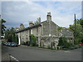
House, Old Bury Road, Thetford
Dated 1838 https://historicengland.org.uk/listing/the-list/list-entry/1195916?section=official-listing
Image: © Jonathan Thacker
Taken: 3 Aug 2021
0.03 miles
3
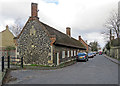
Thetford: Fulmerston's Almshouses
Grade II* listed almshouses built in 1610 under provisions of the will of Sir Richard Fulmerston. The building was reworked in the late 19th century and restored in 1968.
Image: © John Sutton
Taken: 6 Mar 2020
0.04 miles
4
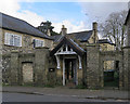
Thetford: St Mary's House
I was taken by the charming Arts & Crafts lettering on the porch.
Image: © John Sutton
Taken: 6 Mar 2020
0.04 miles
5
![Thetford houses [18]](https://s1.geograph.org.uk/geophotos/06/71/63/6716321_ea9789b7_120x120.jpg)
Thetford houses [18]
St Mary's House is a large 19th century property that has been extended and converted into flats.
Once the ancient capital of East Anglia, Thetford is a market town established at a crossing of the River Little Ouse. A major centre of Boudica’s Iceni tribe with an Iron Age fort. Later came a Norman castle and an important priory. Thetford is the birthplace of 18th century radical Thomas Paine, whose thinking encouraged American independence and the abolition of slavery. After World War II, Thetford became an "overspill town", taking people from London.
Image: © Michael Dibb
Taken: 8 Sep 2020
0.04 miles
6
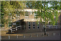
Thetford Court House
This building houses the Thetford (South Norfolk) Magistrates' Court. It stands on the bank of the Little Ouse River to the south of the town centre.
Image: © Stephen McKay
Taken: 5 May 2007
0.04 miles
7
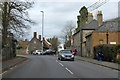
A134 Bury Road, Thetford
The A134 turns left off the route of the old road, now called Old Bury Road. On the left of the old road are Fulmerston's Almshouses, founded 1610, a grade II*(star) listed building. The building on the right is grade II listed, mid 19th century.
Image: © Robin Webster
Taken: 7 Mar 2020
0.05 miles
8
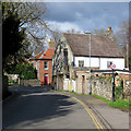
Thetford: on Old Bury Road
Sunlight, shadows and a roll-call of traditional Norfolk building materials.
Image: © John Sutton
Taken: 6 Mar 2020
0.05 miles
9
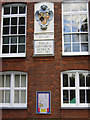
Thetford Girls' Grammar School
The Girls' Grammar School was established in Victorian times as a counterpart to the very long-established boys' school across the road. The two schools merged in 1975 and became an independent grammar school in 1981. The former girls' school buildings are now used to accommodate the junior section of the school.
Image: © Stephen McKay
Taken: 25 Sep 2010
0.05 miles
10
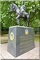
Statue of Duleep Singh
Maharaja Sir Duleep Singh the last Majaraja of the Punjab.
Image: © Philip Halling
Taken: 30 Jun 2022
0.06 miles