
IMAGES TAKEN NEAR TO
Bridge Street, THETFORD, IP24 3AD
Introduction
This page details the photographs taken nearby to Bridge Street, IP24 3AD by members of the Geograph project.
The Geograph project started in 2005 with the aim of publishing, organising and preserving representative images for every square kilometre of Great Britain, Ireland and the Isle of Man.

There are currently over 7.5m images from over14,400 individuals and you can help contribute to the project by visiting https://www.geograph.org.uk
Image Map
Images are licensed for reuse under creativecommons.org/licenses/by-sa/2.0
Notes
- Clicking on the map will re-center to the selected point.
- The higher the marker number, the further away the image location is from the centre of the postcode.
Image Listing (778 Images Found)
Images are licensed for reuse under creativecommons.org/licenses/by-sa/2.0
Image
Details
Distance
1
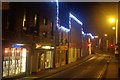
Bridge Street, Thetford
Christmas night and Thetford's town centre is deserted. Traditionally, this is the one night of the year when pubs stay closed, although the bar of the Bell Inn (just ahead on the right) was open - but hardly very busy. A few of the town's Polish food stores were also open but did not appear to be doing much trade.
Image: © Stephen McKay
Taken: 25 Dec 2011
0.00 miles
2
![Thetford buildings [21]](https://s0.geograph.org.uk/geophotos/06/71/45/6714580_29b9ccc5_120x120.jpg)
Thetford buildings [21]
Numbers 12 and 14 were built as shops with accommodation above in the early 19th century in knapped flint with gault brick dressings. Number 14 had a fine mid 19th century shop front whilst number 12 has a late 20th century shop front. Listed, grade II, with details at: https://historicengland.org.uk/listing/the-list/list-entry/1195950
Once the ancient capital of East Anglia, Thetford is a market town established at a crossing of the River Little Ouse. A major centre of Boudica’s Iceni tribe with an Iron Age fort. Later came a Norman castle and an important priory. Thetford is the birthplace of 18th century radical Thomas Paine, whose thinking encouraged American independence and the abolition of slavery. After World War II, Thetford became an "overspill town", taking people from London.
Image: © Michael Dibb
Taken: 8 Sep 2020
0.01 miles
3
![Thetford features [1]](https://s1.geograph.org.uk/geophotos/06/71/46/6714605_40b7141c_120x120.jpg)
Thetford features [1]
A view of Town Bridge which carries Bridge Street over the River Little Ouse. On the right is Bridge House Image and on the left the Bell Inn and the church of St Peter Image The bridge in detail is seen at Image and there is a descriptive information board Image The bridge is listed, grade II, with details at: https://historicengland.org.uk/listing/the-list/list-entry/1195954
Once the ancient capital of East Anglia, Thetford is a market town established at a crossing of the River Little Ouse. A major centre of Boudica’s Iceni tribe with an Iron Age fort. Later came a Norman castle and an important priory. Thetford is the birthplace of 18th century radical Thomas Paine, whose thinking encouraged American independence and the abolition of slavery. After World War II, Thetford became an "overspill town", taking people from London.
Image: © Michael Dibb
Taken: 8 Sep 2020
0.01 miles
5

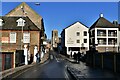
12-14 Bridge Street
Grade II listed, early 19th century shops with accommodation above
Image: © Richard Croft
Taken: 6 Sep 2013
0.01 miles
6
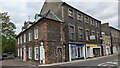
Bridge House, 12 and 14 Bridge Street, Thetford
https://historicengland.org.uk/listing/the-list/list-entry/1207462?section=official-list-entry and https://historicengland.org.uk/listing/the-list/list-entry/1195950?section=official-list-entry
Image: © Sandy Gerrard
Taken: 2 May 2023
0.01 miles
7
![Thetford buildings [20]](https://s0.geograph.org.uk/geophotos/06/71/45/6714560_098bf3c2_120x120.jpg)
Thetford buildings [20]
Built as two shops with accommodation above the building at numbers 6 and 8 Bridge Street now houses two shops and seven flats at numbers 1 to 7 Bridgate Court. Constructed in the early 19th century in flint, brick and clunch and fronted in gault brick. The two shop fronts are late 20th century. The conversion to flats took place in the late 20th century. Listed, grade II, with details at: https://historicengland.org.uk/listing/the-list/list-entry/1195949
Once the ancient capital of East Anglia, Thetford is a market town established at a crossing of the River Little Ouse. A major centre of Boudica’s Iceni tribe with an Iron Age fort. Later came a Norman castle and an important priory. Thetford is the birthplace of 18th century radical Thomas Paine, whose thinking encouraged American independence and the abolition of slavery. After World War II, Thetford became an "overspill town", taking people from London.
Image: © Michael Dibb
Taken: 8 Sep 2020
0.01 miles
8
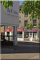
Bridge Street, Thetford
Quiet on a bank holiday Monday, it is hard to believe that Bridge Street was once a part of the A11 London - Norwich road. The modern part of the Bell Inn is on the left.
Image: © Stephen McKay
Taken: 26 Aug 2013
0.01 miles
10

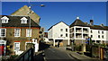
Bridge Street, Thetford
The original main road from London to Norwich. St Peter's Church stands ahead. The Bell Inn on the right can apparently claim its own ghost story.
Image: © Bill Boaden
Taken: 28 Dec 2013
0.01 miles