IMAGES TAKEN NEAR TO
Bridge Street, THETFORD, IP24 3AB
Introduction
This page details the photographs taken nearby to Bridge Street, IP24 3AB by members of the Geograph project.
The Geograph project started in 2005 with the aim of publishing, organising and preserving representative images for every square kilometre of Great Britain, Ireland and the Isle of Man.

There are currently over 7.5m images from over14,400 individuals and you can help contribute to the project by visiting https://www.geograph.org.uk
Image Map
Images are licensed for reuse under creativecommons.org/licenses/by-sa/2.0
Notes
- Clicking on the map will re-center to the selected point.
- The higher the marker number, the further away the image location is from the centre of the postcode.
Image Listing (773 Images Found)
Images are licensed for reuse under creativecommons.org/licenses/by-sa/2.0
Image
Details
Distance
1
![Thetford buildings [17]](https://s1.geograph.org.uk/geophotos/06/71/45/6714557_ec8c470a_120x120.jpg)
Thetford buildings [17]
Bank House has entrances in both Bridge Street and Minstergate. Built, in the early 19th century in gault brick as a range of shops, now a bank and shop. The building consists of a central five bay block with projecting wings. A recent addition to the front is this hideous entranceway. A view of the left wing is at Image and a view of the right wing is at Image Listed, grade II, with details at: https://historicengland.org.uk/listing/the-list/list-entry/1297877
Once the ancient capital of East Anglia, Thetford is a market town established at a crossing of the River Little Ouse. A major centre of Boudica’s Iceni tribe with an Iron Age fort. Later came a Norman castle and an important priory. Thetford is the birthplace of 18th century radical Thomas Paine, whose thinking encouraged American independence and the abolition of slavery. After World War II, Thetford became an "overspill town", taking people from London.
Image: © Michael Dibb
Taken: 8 Sep 2020
0.01 miles
2
![Thetford buildings [19]](https://s3.geograph.org.uk/geophotos/06/71/45/6714559_d7c48826_120x120.jpg)
Thetford buildings [19]
Bank House has entrances in both Bridge Street and Minstergate. Built, in the early 19th century in gault brick as a range of shops, now a bank and shop. The building consists of a central five bay block with projecting wings. This is the right wing. A view of the centre blocks is at Image and a view of the left wing is at Image Listed, grade II, with details at: https://historicengland.org.uk/listing/the-list/list-entry/1297877
Once the ancient capital of East Anglia, Thetford is a market town established at a crossing of the River Little Ouse. A major centre of Boudica’s Iceni tribe with an Iron Age fort. Later came a Norman castle and an important priory. Thetford is the birthplace of 18th century radical Thomas Paine, whose thinking encouraged American independence and the abolition of slavery. After World War II, Thetford became an "overspill town", taking people from London.
Image: © Michael Dibb
Taken: 8 Sep 2020
0.01 miles
3
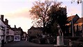
The bottom of King Street
Bell Hotel, St Peter's (redundant) church and Citizen Tom Paine on a plinth in his home town.
Image: © Chris Brown
Taken: 5 Nov 2017
0.01 miles
4
![Thetford buildings [15]](https://s1.geograph.org.uk/geophotos/06/71/45/6714529_d6320894_120x120.jpg)
Thetford buildings [15]
Number 1 White Hart Street is now known as Minstergate House. Built as a house in the 18th century, it was converted to a house and shop and refronted in the early 19th century at which time a large extension was added facing St Nicholas Street.e and shop. The building was used as a place of worship from the 1980s until 2012 when it was known as Kingdom Hall. Listed, grade II, with details at: https://historicengland.org.uk/listing/the-list/list-entry/1291577
Once the ancient capital of East Anglia, Thetford is a market town established at a crossing of the River Little Ouse. A major centre of Boudica’s Iceni tribe with an Iron Age fort. Later came a Norman castle and an important priory. Thetford is the birthplace of 18th century radical Thomas Paine, whose thinking encouraged American independence and the abolition of slavery. After World War II, Thetford became an "overspill town", taking people from London.
Image: © Michael Dibb
Taken: 8 Sep 2020
0.01 miles
5
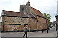
Kingdom Hall
Grade II listed. http://www.britishlistedbuildings.co.uk/101291577-kingdom-hall-thetford
Image: © N Chadwick
Taken: 29 Apr 2017
0.01 miles
6
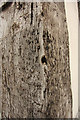
Corner post
Detail of the corner post of the Bell Inn http://www.geograph.org.uk/photo/3648078 with hundreds of iron nail heads where, for centuries, public proclamations were posted.
Image: © Richard Croft
Taken: 6 Sep 2013
0.01 miles
7
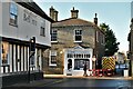
Thetford: Bridge Street from White Hart Street
Image: © Michael Garlick
Taken: 27 Jan 2022
0.01 miles
8
![Thetford buildings [18]](https://s2.geograph.org.uk/geophotos/06/71/45/6714558_c23a7aa5_120x120.jpg)
Thetford buildings [18]
Bank House has entrances in both Bridge Street and Minstergate. Built, in the early 19th century in gault brick as a range of shops, now a bank and shop. The building consists of a central five bay block with projecting wings. This is the left wing. A view of the centre blocks is at Image and a view of the right wing is at Image Listed, grade II, with details at: https://historicengland.org.uk/listing/the-list/list-entry/1297877Once the ancient capital of East Anglia, Thetford is a market town established at a crossing of the River Little Ouse. A major centre of Boudica’s Iceni tribe with an Iron Age fort. Later came a Norman castle and an important priory. Thetford is the birthplace of 18th century radical Thomas Paine, whose thinking encouraged American independence and the abolition of slavery. After World War II, Thetford became an "overspill town", taking people from London.
Image: © Michael Dibb
Taken: 8 Sep 2020
0.01 miles
9
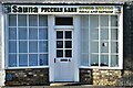
Thetford: Sultan Sauna; 6, Bridge Street
'Sultan Sauna' is the translation from the Cyrillic Script.
Image: © Michael Garlick
Taken: 27 Jan 2022
0.01 miles