IMAGES TAKEN NEAR TO
Park Ride, THETFORD, IP24 2QU
Introduction
This page details the photographs taken nearby to Park Ride, IP24 2QU by members of the Geograph project.
The Geograph project started in 2005 with the aim of publishing, organising and preserving representative images for every square kilometre of Great Britain, Ireland and the Isle of Man.

There are currently over 7.5m images from over14,400 individuals and you can help contribute to the project by visiting https://www.geograph.org.uk
Image Map
Images are licensed for reuse under creativecommons.org/licenses/by-sa/2.0
Notes
- Clicking on the map will re-center to the selected point.
- The higher the marker number, the further away the image location is from the centre of the postcode.
Image Listing (19 Images Found)
Images are licensed for reuse under creativecommons.org/licenses/by-sa/2.0
Image
Details
Distance
1
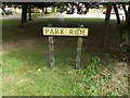
Park Ride sign
Off the A1088 Thetford Road
Image: © Geographer
Taken: 6 Sep 2016
0.02 miles
2
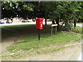
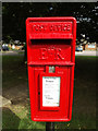
Park Ride Postbox
Off the A1088 Thetford Road
Postbox No.IP24 3343D
Image: © Geographer
Taken: 6 Sep 2016
0.02 miles
3
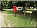
Park Ride Postbox
Off the A1088 Thetford Road
Postbox No.IP24 3343D
Image: © Geographer
Taken: 6 Sep 2016
0.02 miles
4
Park Ride Postbox
Off the A1088 Thetford Road
Postbox No.IP24 3343D
Image: © Geographer
Taken: 6 Sep 2016
0.02 miles
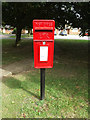
5
Park Ride Postbox
Off the A1088 Thetford Road
Postbox No.IP24 3343D
(Close up)
Image: © Geographer
Taken: 6 Sep 2016
0.02 miles
6
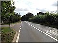
A1088 Thetford Road, Fakenham Magna
At the junction with Pike Ride
Image: © Geographer
Taken: 6 Sep 2016
0.03 miles
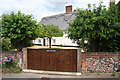
7
Suffolk Village
The village sign greets the motorists who pass through Fakenham Magna in Suffolk. It takes less than a minute to drive through the village!
Image: © David Williams
Taken: 21 Jul 2006
0.08 miles
8
Field Cottage, Fakenham Magna
An attractive cottage at Fakenham Magna, viewed from the footpath alongside the A1088.
Image: © Bob Jones
Taken: 18 Jun 2009
0.11 miles
9
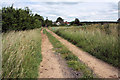
Butt Lane, Fakenham Magna
This farm track is also a public footpath, leading to the A1088 at Fakenham Magna.
Image: © Bob Jones
Taken: 18 Jun 2009
0.12 miles
10
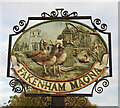
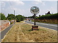
Fakenham Magna village sign
The village pump looms large and represents Pump Cottage which can be seen opposite the Bardwell Road junction. I don't think the pump is any longer extant. The church also features but I've never found it accessible. The geese probably frequent the River Blackbourne, the bridge which spans the river is situated in Bardwell Road and is represented on the right beneath a weeping willow tree.
https://www.geograph.org.uk/photo/6663354
Image: © Adrian S Pye
Taken: 3 Nov 2020
0.13 miles