
IMAGES TAKEN NEAR TO
Station Road, THETFORD, IP24 2PD
Introduction
This page details the photographs taken nearby to Station Road, IP24 2PD by members of the Geograph project.
The Geograph project started in 2005 with the aim of publishing, organising and preserving representative images for every square kilometre of Great Britain, Ireland and the Isle of Man.

There are currently over 7.5m images from over14,400 individuals and you can help contribute to the project by visiting https://www.geograph.org.uk
Image Map
Images are licensed for reuse under creativecommons.org/licenses/by-sa/2.0
Notes
- Clicking on the map will re-center to the selected point.
- The higher the marker number, the further away the image location is from the centre of the postcode.
Image Listing (19 Images Found)
Images are licensed for reuse under creativecommons.org/licenses/by-sa/2.0
Image
Details
Distance
3

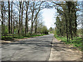
Station Road, Barnham
These conifers are the main tree in and around Elveden Forest
Image: © David Howard
Taken: 18 Apr 2021
0.09 miles
5

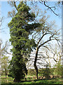
Barnham Station (remains)
A rather uninspiring view southwards, towards Bury St Edmunds, at the site of the station on the Bury St Edmunds - Thetford branch, which closed to passengers way back on 8/6/53, for Goods on 27/6/60. However, it had seen heavy traffic in World War Two, when there was a major Ammunition Supply Depot at Barnham serving the many RAF and USAAF Bomber Airfields in the vicinity.
Image: © Ben Brooksbank
Taken: 2 Aug 1969
0.11 miles
8

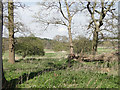
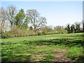
Route of disused railway near Barnham
The railway line between Bury St Edmunds and Thetford was closed to passengers in 1953. Much of the route is no longer visible, such as immediately south of this point, where buildings now straddle the former line. But looking northwards, as here, the route can be clearly seen. It is not a public footpath, however.
Image: © Bob Jones
Taken: 27 Nov 2009
0.13 miles
9
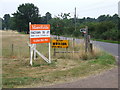
Signs at start of Byway
Signs at the start of the Byway with Station Road in the background Barnham Suffolk.
Image: © Keith Evans
Taken: 31 Jul 2008
0.15 miles
10
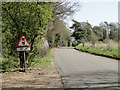
Traffic lights ahead on the A134 at Barnham
Image: © Adrian S Pye
Taken: 15 Apr 2015
0.15 miles