IMAGES TAKEN NEAR TO
Fisher Way, THETFORD, IP24 2LD
Introduction
This page details the photographs taken nearby to Fisher Way, IP24 2LD by members of the Geograph project.
The Geograph project started in 2005 with the aim of publishing, organising and preserving representative images for every square kilometre of Great Britain, Ireland and the Isle of Man.

There are currently over 7.5m images from over14,400 individuals and you can help contribute to the project by visiting https://www.geograph.org.uk
Image Map
Images are licensed for reuse under creativecommons.org/licenses/by-sa/2.0
Notes
- Clicking on the map will re-center to the selected point.
- The higher the marker number, the further away the image location is from the centre of the postcode.
Image Listing (19 Images Found)
Images are licensed for reuse under creativecommons.org/licenses/by-sa/2.0
Image
Details
Distance
3
Churchill Road looking towards Fisher Way
Image: © David Howard
Taken: 18 Apr 2021
0.07 miles
4
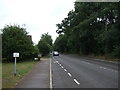
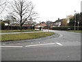
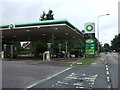
Approaching the A1074 from Churchill Road
Image: © Adrian S Pye
Taken: 13 Nov 2018
0.07 miles
5
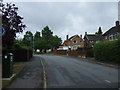
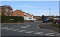
Norwich Road at the junction of Churchill Road
Image: © David Howard
Taken: 27 Mar 2018
0.08 miles
6
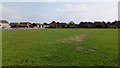
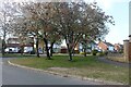
School Playing Field
The grass has greatly recovered after the hot, dry summer, announced by the Met Office as the join hottest summer on record.
Image: © Stuart Shepherd
Taken: 3 Sep 2018
0.08 miles
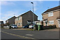
10
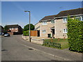
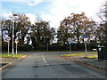
Harwood Avenue, Thetford
Part of the Admirals Estate to the north east of the town.
Image: © Stephen McKay
Taken: 4 Jun 2006
0.12 miles