IMAGES TAKEN NEAR TO
Nickerson Yard, THETFORD, IP24 2DU
Introduction
This page details the photographs taken nearby to Nickerson Yard, IP24 2DU by members of the Geograph project.
The Geograph project started in 2005 with the aim of publishing, organising and preserving representative images for every square kilometre of Great Britain, Ireland and the Isle of Man.

There are currently over 7.5m images from over14,400 individuals and you can help contribute to the project by visiting https://www.geograph.org.uk
Image Map
Images are licensed for reuse under creativecommons.org/licenses/by-sa/2.0
Notes
- Clicking on the map will re-center to the selected point.
- The higher the marker number, the further away the image location is from the centre of the postcode.
Image Listing (534 Images Found)
Images are licensed for reuse under creativecommons.org/licenses/by-sa/2.0
Image
Details
Distance
2
![Thetford houses [28]](https://s1.geograph.org.uk/geophotos/06/71/81/6718125_09a2e305_120x120.jpg)
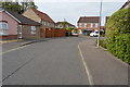
Thetford houses [28]
Numbers 43 and 45 Castle Street are a symmetrical pair of houses, built in flint with gault brick dressings in the mid 19th century. There is a central passage to the rear. Listed, grade II, with details at: https://historicengland.org.uk/listing/the-list/list-entry/1279668
Once the ancient capital of East Anglia, Thetford is a market town established at a crossing of the River Little Ouse. A major centre of Boudica’s Iceni tribe with an Iron Age fort. Later came a Norman castle and an important priory. Thetford is the birthplace of 18th century radical Thomas Paine, whose thinking encouraged American independence and the abolition of slavery. After World War II, Thetford became an "overspill town", taking people from London.
Image: © Michael Dibb
Taken: 8 Sep 2020
0.03 miles
5
![Thetford houses [30]](https://s2.geograph.org.uk/geophotos/06/71/81/6718142_ee400374_120x120.jpg)
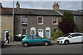
Thetford houses [30]
Number 30 Castle Street (nearest the camera) is an early 19th century house in flint, coursed clunch and brick, re-skinned in brown brick circa 1888. Listed, grade II, with details at: https://historicengland.org.uk/listing/the-list/list-entry/1195923
The terrace of three houses, numbers 32,34 and 36 Castle Street, was built circa 1830 in flint with gault brick dressings. Each property is defined by quoins. Number 32 has an early 19th century shop window. The shop fronts to numbers 34 and 35 have been replaced. Listed, grade II, with details at: https://historicengland.org.uk/listing/the-list/list-entry/1207589
Once the ancient capital of East Anglia, Thetford is a market town established at a crossing of the River Little Ouse. A major centre of Boudica’s Iceni tribe with an Iron Age fort. Later came a Norman castle and an important priory. Thetford is the birthplace of 18th century radical Thomas Paine, whose thinking encouraged American independence and the abolition of slavery. After World War II, Thetford became an "overspill town", taking people from London.
Image: © Michael Dibb
Taken: 8 Sep 2020
0.04 miles
6
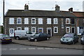
54 - 60, Magdalen St
Grade II listed. http://www.britishlistedbuildings.co.uk/101195904-54-60-magdalen-street-thetford
Image: © N Chadwick
Taken: 29 Apr 2017
0.04 miles
8
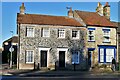
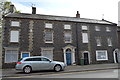
Thetford: Two dwellings in Castle Street
Image: © Michael Garlick
Taken: 27 Jan 2022
0.05 miles
9
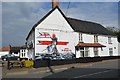
Mural, The Black Horse
Grade II listed. http://www.britishlistedbuildings.co.uk/101297894-black-horse-public-house-thetford
Image: © N Chadwick
Taken: 29 Apr 2017
0.05 miles