
IMAGES TAKEN NEAR TO
Stow Bedon Road, THETFORD, IP24 1QH
Introduction
This page details the photographs taken nearby to Stow Bedon Road, IP24 1QH by members of the Geograph project.
The Geograph project started in 2005 with the aim of publishing, organising and preserving representative images for every square kilometre of Great Britain, Ireland and the Isle of Man.

There are currently over 7.5m images from over14,400 individuals and you can help contribute to the project by visiting https://www.geograph.org.uk
Image Map
Images are licensed for reuse under creativecommons.org/licenses/by-sa/2.0
Notes
- Clicking on the map will re-center to the selected point.
- The higher the marker number, the further away the image location is from the centre of the postcode.
Image Listing (38 Images Found)
Images are licensed for reuse under creativecommons.org/licenses/by-sa/2.0
Image
Details
Distance
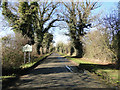

3
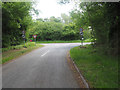
Junction of minor road from Thompson and A1075
Image: © David Pashley
Taken: 26 May 2019
0.09 miles
4
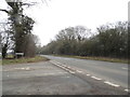
Stow Bedon Road at the junction of Watton Road
Image: © David Howard
Taken: 24 Mar 2018
0.11 miles
5

Road to Watton
A view of the A1075 towards Watton, Norfolk. This is the site of the old level crossing of the Thetford to Swaffham line.
Image: © Ashley Dace
Taken: 9 Jul 2010
0.19 miles
6
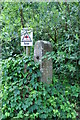
Old Concrete Post
Possibly part of the old level crossing for Stow Bedon railway station. The line closed in 1964.
Image: © Ashley Dace
Taken: 9 Jul 2010
0.20 miles
7
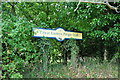
The Great Eastern Pingo Trail
The Great Eastern Railways Thetford to Swaffham line ran past here, hence the station style sign. The pingo trail runs along part of the old trackbed.
The opening of the Thetford to Watton railway line on 18th October 1869 by the Thetford and Watton railway Company was a great opportunity. Sadly the line closed in the Beeching axe of 1964.
Image: © Ashley Dace
Taken: 9 Jul 2010
0.20 miles
9

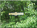
Track and gate, Thompson Common
Leading from the wooded to the more open part of the common. This path is part of the Great Eastern Pingo Trail.
This photo is part of a series following the route clockwise.
Next: Image
Previous: Image
Image: © Katy Walters
Taken: 21 Mar 2009
0.21 miles
10

From the Pingo Trail
Part of the woods on Thompson Common, beside the Great Eastern Pingo Trail.
This photo is part of a series following the route clockwise.
Next: Image
Previous: Image
Image: © Katy Walters
Taken: 21 Mar 2009
0.22 miles