IMAGES TAKEN NEAR TO
Cherry Blossom Drive, THETFORD, IP24 1FQ
Introduction
This page details the photographs taken nearby to Cherry Blossom Drive, IP24 1FQ by members of the Geograph project.
The Geograph project started in 2005 with the aim of publishing, organising and preserving representative images for every square kilometre of Great Britain, Ireland and the Isle of Man.

There are currently over 7.5m images from over14,400 individuals and you can help contribute to the project by visiting https://www.geograph.org.uk
Image Map
Images are licensed for reuse under creativecommons.org/licenses/by-sa/2.0
Notes
- Clicking on the map will re-center to the selected point.
- The higher the marker number, the further away the image location is from the centre of the postcode.
Image Listing (22 Images Found)
Images are licensed for reuse under creativecommons.org/licenses/by-sa/2.0
Image
Details
Distance
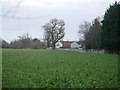
1
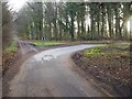
Road junction
Lane goes to Puddledock Caravan Site, road joins A1075 Watton Thetford road round the bend.
Image: © David Pashley
Taken: 2 Jan 2019
0.07 miles
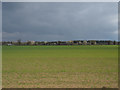
2
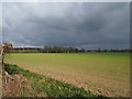
Looking across cereal field with caravan site in distance
Image: © David Pashley
Taken: 14 Apr 2019
0.10 miles
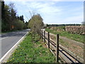
4
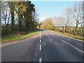
Looking along A1075 from entrance to Bambridge Lane
Image: © David Pashley
Taken: 14 Apr 2019
0.13 miles
7
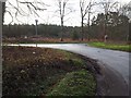
Junction with A1075
Junction of A1075 and a country lane that ends at MOD land about one mile back.
Image: © David Pashley
Taken: 2 Jan 2019
0.14 miles
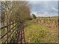
10
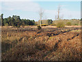
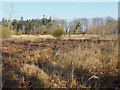
Open area left after last clear fell
Image: © David Pashley
Taken: 14 Apr 2019
0.17 miles