
IMAGES TAKEN NEAR TO
All Saints Court, THETFORD, IP24 1BF
Introduction
This page details the photographs taken nearby to All Saints Court, IP24 1BF by members of the Geograph project.
The Geograph project started in 2005 with the aim of publishing, organising and preserving representative images for every square kilometre of Great Britain, Ireland and the Isle of Man.

There are currently over 7.5m images from over14,400 individuals and you can help contribute to the project by visiting https://www.geograph.org.uk
Image Map
Images are licensed for reuse under creativecommons.org/licenses/by-sa/2.0
Notes
- Clicking on the map will re-center to the selected point.
- The higher the marker number, the further away the image location is from the centre of the postcode.
Image Listing (70 Images Found)
Images are licensed for reuse under creativecommons.org/licenses/by-sa/2.0
Image
Details
Distance
1
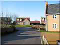
New housing in The Street
The village of Croxton in the Breckland district of Norfolk is situated north of Thetford, covering an area of approximately 19 square kilometres. Croxton has a round-towered parish church dedicated to All Saints > http://www.geograph.org.uk/photo/1697379 and its own general store and Post Office > http://www.geograph.org.uk/photo/1697386.
Image: © Evelyn Simak
Taken: 6 Feb 2010
0.02 miles
2
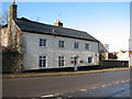
Hill Farm in The Street
The village of Croxton in the Breckland district of Norfolk is situated north of Thetford, covering an area of approximately 19 square kilometres. Croxton has a round-towered parish church dedicated to All Saints > http://www.geograph.org.uk/photo/1697379 and its own general store and Post Office > http://www.geograph.org.uk/photo/1697386.
Image: © Evelyn Simak
Taken: 6 Feb 2010
0.03 miles
3
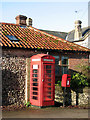
K6 telephone and postbox in The Street
For a wider view of this location see > http://www.geograph.org.uk/photo/1697421.
Image: © Evelyn Simak
Taken: 6 Feb 2010
0.03 miles
4
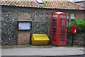
Croxton telephone box
Also a post box, a salt bin, and the parish council notice board.
Image: © Ben Harris
Taken: 2 Oct 2012
0.04 miles
5
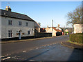
Junction of Church Avenue and The Street
The village of Croxton in the Breckland district of Norfolk is situated north of Thetford, covering an area of approximately 19 square kilometres. Croxton has a round-towered parish church dedicated to All Saints > http://www.geograph.org.uk/photo/1697379 and its own general store and Post Office > http://www.geograph.org.uk/photo/1697386.
Image: © Evelyn Simak
Taken: 6 Feb 2010
0.05 miles
6
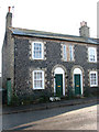
Flint cottages in The Street
The village of Croxton in the Breckland district of Norfolk is situated north of Thetford, covering an area of approximately 19 square kilometres. Croxton has a round-towered parish church dedicated to All Saints > http://www.geograph.org.uk/photo/1697379 and its own general store and Post Office > http://www.geograph.org.uk/photo/1697386.
Image: © Evelyn Simak
Taken: 6 Feb 2010
0.06 miles
7
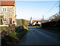
The Street - main thoroughfare through the village of Croxton
The village of Croxton in the Breckland district of Norfolk is situated north of Thetford, covering an area of approximately 19 square kilometres. Croxton has a round-towered parish church dedicated to All Saints, and its own general store and Post Office > http://www.geograph.org.uk/photo/1697386.
Image: © Evelyn Simak
Taken: 6 Feb 2010
0.07 miles
8
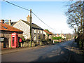
K6 telephone and postbox in The Street
The village of Croxton in the Breckland district of Norfolk is situated north of Thetford, covering an area of approximately 19 square kilometres. Croxton has a round-towered parish church dedicated to All Saints > http://www.geograph.org.uk/photo/1697379 and its own general store and Post Office > http://www.geograph.org.uk/photo/1697386.
Image: © Evelyn Simak
Taken: 6 Feb 2010
0.07 miles
9
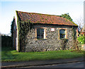
Primitive Methodist chapel in Croxton
The date stone indicates that it was built in 1865 > http://www.geograph.org.uk/photo/1697439. This tiny chapel in The Street appears to be no longer in use.
The village of Croxton in the Breckland district of Norfolk is situated north of Thetford, covering an area of approximately 19 square kilometres. Croxton has a round-towered parish church dedicated to All Saints > http://www.geograph.org.uk/photo/1697379 and its own general store and Post Office > http://www.geograph.org.uk/photo/1697386.
Image: © Evelyn Simak
Taken: 6 Feb 2010
0.07 miles
10
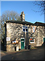
Croxton Post Office and village store
The village of Croxton in the Breckland district of Norfolk is situated north of Thetford, covering an area of approximately 19 square kilometres. Croxton has a round-towered parish church dedicated to All Saints > http://www.geograph.org.uk/photo/1697379 and its own general store and Post Office.
Image: © Evelyn Simak
Taken: 6 Feb 2010
0.08 miles