1
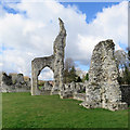
Thetford Priory ruins
View east in the nave of the ruined Priory church
Image: © Richard Croft
Taken: 6 Sep 2013
0.03 miles
2
Thetford Cluniac priory [4]
A view of the presbytery from the nave of the church.
Thetford Cluniac Priory, dedicated to St Mary, was established in 1103 and moved to the present site in 1107 with the River Little Ouse flowing along the southern boundary. It became one of the larger and wealthier religious foundations in Norfolk before its dissolution in 1540. The ruins include the standing and buried remains of the monastic church and conventual buildings and the remains of water control features to the south and west of these. Listed, grade I, with details at: https://historicengland.org.uk/listing/the-list/list-entry/1297875 A Scheduled Ancient Monument with much history and detail at: https://historicengland.org.uk/listing/the-list/list-entry/1017669
Once the ancient capital of East Anglia, Thetford is a market town established at a crossing of the River Little Ouse. A major centre of Boudica’s Iceni tribe, there is an Iron Age fort. Later came a Norman castle and an important priory. Thetford is the birthplace of 18th century radical Thomas Paine, whose thinking encouraged American independence and the abolition of slavery. After World War II, Thetford became an "overspill town", taking people from London.
Image: © Michael Dibb
Taken: 8 Sep 2020
0.03 miles
3
Thetford Priory: remains of the chancel arch
The Cluniac Priory was established in the first decade of the twelfth century and dissolved in 1540. The ruins are Grade I listed.
Image: © John Sutton
Taken: 6 Mar 2020
0.03 miles
4
Thetford Cluniac priory [5]
An information board giving details of the presbytery.
Thetford Cluniac Priory, dedicated to St Mary, was established in 1103 and moved to the present site in 1107 with the River Little Ouse flowing along the southern boundary. It became one of the larger and wealthier religious foundations in Norfolk before its dissolution in 1540. The ruins include the standing and buried remains of the monastic church and conventual buildings and the remains of water control features to the south and west of these. Listed, grade I, with details at: https://historicengland.org.uk/listing/the-list/list-entry/1297875 A Scheduled Ancient Monument with much history and detail at: https://historicengland.org.uk/listing/the-list/list-entry/1017669
Once the ancient capital of East Anglia, Thetford is a market town established at a crossing of the River Little Ouse. A major centre of Boudica’s Iceni tribe, there is an Iron Age fort. Later came a Norman castle and an important priory. Thetford is the birthplace of 18th century radical Thomas Paine, whose thinking encouraged American independence and the abolition of slavery. After World War II, Thetford became an "overspill town", taking people from London.
Image: © Michael Dibb
Taken: 8 Sep 2020
0.03 miles
5
Church at Thetford Cluniac Priory
https://historicengland.org.uk/listing/the-list/list-entry/1017669?section=official-list-entry
Image: © Sandy Gerrard
Taken: 2 May 2023
0.03 miles
6
Ruins at Thetford Priory
Photograph taken in 1965.
Image: © Clint Mann
Taken: Unknown
0.04 miles
7
Thetford Priory: the ruined nave of the Priory Church
The Cluniac Priory was established in the first decade of the twelfth century and dissolved in 1540. The ruins are Grade I listed. The stumps of the Romanesque columns (flint-cored and ashlar-faced) give an idea of the cathedral proportions of the Priory Church. The ruins of the Prior's Lodgings are in the middle distance.
Image: © John Sutton
Taken: 6 Mar 2020
0.04 miles
8
Thetford Cluniac priory [6]
The church, looking east.
Thetford Cluniac Priory, dedicated to St Mary, was established in 1103 and moved to the present site in 1107 with the River Little Ouse flowing along the southern boundary. It became one of the larger and wealthier religious foundations in Norfolk before its dissolution in 1540. The ruins include the standing and buried remains of the monastic church and conventual buildings and the remains of water control features to the south and west of these. Listed, grade I, with details at: https://historicengland.org.uk/listing/the-list/list-entry/1297875 A Scheduled Ancient Monument with much history and detail at: https://historicengland.org.uk/listing/the-list/list-entry/1017669
Once the ancient capital of East Anglia, Thetford is a market town established at a crossing of the River Little Ouse. A major centre of Boudica’s Iceni tribe, there is an Iron Age fort. Later came a Norman castle and an important priory. Thetford is the birthplace of 18th century radical Thomas Paine, whose thinking encouraged American independence and the abolition of slavery. After World War II, Thetford became an "overspill town", taking people from London.
Image: © Michael Dibb
Taken: 8 Sep 2020
0.04 miles
9
Ruins of Thetford Priory
Image: © Philip Halling
Taken: 30 Jun 2022
0.04 miles
10
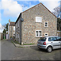
Thetford: the end of Abbey Green
Flint cottages on a cul-de-sac off St Nicholas Street.
Image: © John Sutton
Taken: 6 Mar 2020
0.04 miles


![Thetford Cluniac priory [4]](https://s1.geograph.org.uk/geophotos/06/71/25/6712593_ef163c0c_120x120.jpg)

![Thetford Cluniac priory [5]](https://s1.geograph.org.uk/geophotos/06/71/26/6712625_43abc7b4_120x120.jpg)


![Thetford Cluniac priory [6]](https://s0.geograph.org.uk/geophotos/06/71/26/6712628_bd24cf72_120x120.jpg)

