1
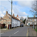
Station Rd
Image: © N Chadwick
Taken: 29 Apr 2017
0.02 miles
2
Station Rd
Image: © N Chadwick
Taken: 29 Apr 2017
0.02 miles
3
Thetford: painted flint and rusty iron
Looking down Miller's Lane past Abbey Garage to the Grade II listed houses shown in
Image
Image: © John Sutton
Taken: 6 Mar 2020
0.03 miles
4
Thetford houses [4]
Number 22 Miller's Lane is a house in flint with gault brick dressings dated 1831 on the gable end. Listed, grade II, with details at: https://historicengland.org.uk/listing/the-list/list-entry/1297896
Once the ancient capital of East Anglia, Thetford is a market town established at a crossing of the River Little Ouse. A major centre of Boudica’s Iceni tribe and there is an Iron Age fort. Later came a Norman castle and an important priory. Thetford is the birthplace of 18th century radical Thomas Paine, whose thinking encouraged American independence and the abolition of slavery. After World War II, Thetford became an "overspill town", taking people from London.
Image: © Michael Dibb
Taken: 8 Sep 2020
0.03 miles
5
Thetford: up Station Road
The lintel on the white house to the right of centre is incised with the name Prospect Cottage.
Image: © John Sutton
Taken: 6 Mar 2020
0.03 miles
6
Painter Street, Thetford
Terrace of flint-faced houses, typical of the older parts of the town.
Image: © Stephen McKay
Taken: 16 Dec 2007
0.03 miles
7
Thetford: almshouses on Station Road
The John Phillips Watts Memorial Almshouses were built in 1936.
Image: © John Sutton
Taken: 6 Mar 2020
0.03 miles
8
Thetford houses [3]
Numbers 62 and 64 St Nicholas Street are a pair of houses, built circa 1820 in flint with gault brick dressings and a little clunch. Listed, grade II, with details at: https://historicengland.org.uk/listing/the-list/list-entry/1219185
Once the ancient capital of East Anglia, Thetford is a market town established at a crossing of the River Little Ouse. A major centre of Boudica’s Iceni tribe and there is an Iron Age fort. Later came a Norman castle and an important priory. Thetford is the birthplace of 18th century radical Thomas Paine, whose thinking encouraged American independence and the abolition of slavery. After World War II, Thetford became an "overspill town", taking people from London.
Image: © Michael Dibb
Taken: 8 Sep 2020
0.03 miles
9
Thetford: a terrace on Station Road
Numbers 39 and 41 and the twentieth-century redbrick houses on the other side of the road are perpendicular, but the north end of the terrace has a pronounced lean.
Image: © John Sutton
Taken: 6 Mar 2020
0.04 miles
10
Thetford: listed buildings on St Nicholas Street
Grade II listed nineteenth-century brick-and-flint houses, the flint frontage of the pair on the left painted.
Image: © John Sutton
Taken: 6 Mar 2020
0.04 miles


![Thetford houses [4]](https://s2.geograph.org.uk/geophotos/06/71/32/6713230_9f8eeff9_120x120.jpg)


![Thetford houses [3]](https://s2.geograph.org.uk/geophotos/06/71/32/6713226_dd25034c_120x120.jpg)

