IMAGES TAKEN NEAR TO
Hoxne Road, EYE, IP23 7NL
Introduction
This page details the photographs taken nearby to Hoxne Road, IP23 7NL by members of the Geograph project.
The Geograph project started in 2005 with the aim of publishing, organising and preserving representative images for every square kilometre of Great Britain, Ireland and the Isle of Man.

There are currently over 7.5m images from over14,400 individuals and you can help contribute to the project by visiting https://www.geograph.org.uk
Image Map
Images are licensed for reuse under creativecommons.org/licenses/by-sa/2.0
Notes
- Clicking on the map will re-center to the selected point.
- The higher the marker number, the further away the image location is from the centre of the postcode.
Image Listing (23 Images Found)
Images are licensed for reuse under creativecommons.org/licenses/by-sa/2.0
Image
Details
Distance
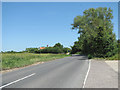
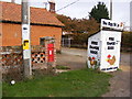
1
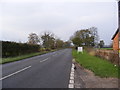
The B1117 Hoxne Road
Looking towards Eye near the Postbox and Burnt House Farm
Image: © Geographer
Taken: 21 Nov 2011
0.17 miles
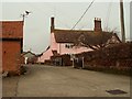
6
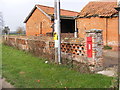
Burnt House Hoxne Road Victorian Postbox
Postbox No.IP23 7089
Image: © Geographer
Taken: 21 Nov 2011
0.19 miles
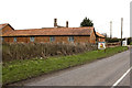
7
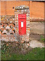
Burnt House Hoxne Road Victorian Postbox
Postbox No.IP23 7089
Image: © Geographer
Taken: 21 Nov 2011
0.19 miles
8
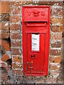
Burnt House Hoxne Road Victorian Postbox
Postbox No.IP23 7089
Image: © Geographer
Taken: 21 Nov 2011
0.19 miles
9
Burnt House Hoxne Road Victorian Postbox
Postbox No.IP23 7089
Image: © Geographer
Taken: 21 Nov 2011
0.19 miles
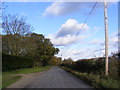
10
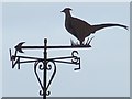
Weather Vane
Pheasant weather vane on Burnt House Farm near to Eye, Suffolk.
Image: © Keith Evans
Taken: 18 Oct 2009
0.19 miles