
IMAGES TAKEN NEAR TO
Church Lane, EYE, IP23 7EJ
Introduction
This page details the photographs taken nearby to Church Lane, IP23 7EJ by members of the Geograph project.
The Geograph project started in 2005 with the aim of publishing, organising and preserving representative images for every square kilometre of Great Britain, Ireland and the Isle of Man.

There are currently over 7.5m images from over14,400 individuals and you can help contribute to the project by visiting https://www.geograph.org.uk
Image Map
Images are licensed for reuse under creativecommons.org/licenses/by-sa/2.0
Notes
- Clicking on the map will re-center to the selected point.
- The higher the marker number, the further away the image location is from the centre of the postcode.
Image Listing (63 Images Found)
Images are licensed for reuse under creativecommons.org/licenses/by-sa/2.0
Image
Details
Distance
1
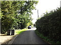
Church Lane, Thwaite
Near St.Georges Church
Image: © Geographer
Taken: 12 Sep 2015
0.07 miles
2
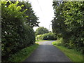
Church Lane, Thwaite
Near St.George's Church
Image: © Geographer
Taken: 12 Sep 2015
0.07 miles
3
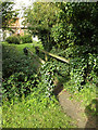
Footbridge to St. George's Church
Off Church Lane
Image: © Geographer
Taken: 12 Sep 2015
0.07 miles
4
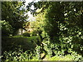
Path to St. George's Church
Off Church Lane
Image: © Geographer
Taken: 12 Sep 2015
0.08 miles
6
St.George's Church, Thwaite
Off Church Lane
Image: © Geographer
Taken: 12 Sep 2015
0.08 miles
7
Thwaite (Suffolk) St George's church
The church is redundant and is due for conversion into a Village Hall, planning permitting. More information is available in my book, ‘A photographic and Historical Guide to the Parish Churches of West Suffolk’.
Image: © Adrian S Pye
Taken: 20 Sep 2008
0.08 miles
8
St.George's Church, Thwaite
Off Church Lane at the junction with Wickham Road
Image: © Geographer
Taken: 12 Sep 2015
0.08 miles
10
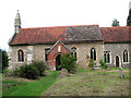
St George's church, Thwaite
St George's church > http://www.geograph.org.uk/photo/2116549 is redundant and hasrecently been purchased by the community to be converted into their village hall. When the tower fell it was never rebuilt but the material was used instead for building the schoolroom > http://www.geograph.org.uk/photo/2116005 which is situated a short distance to the north-east, on the corner of the churchyard. The interior of the building is in the process of being restored and converted and most of the furnishings will be in all probability be removed but some, such as the elaborately carved pulpit > http://www.geograph.org.uk/photo/2116565 - it looks very similar to the famous Wycliffe pulpit in St Mary's church, Lutterworth (Leicestershire) may soon be exhibited in a museum. The 14th century font > http://www.geograph.org.uk/photo/2116620 will most likely stay where it is.
Image: © Evelyn Simak
Taken: 17 Oct 2010
0.09 miles