
IMAGES TAKEN NEAR TO
High Road, DISS, IP22 5RF
Introduction
This page details the photographs taken nearby to High Road, IP22 5RF by members of the Geograph project.
The Geograph project started in 2005 with the aim of publishing, organising and preserving representative images for every square kilometre of Great Britain, Ireland and the Isle of Man.

There are currently over 7.5m images from over14,400 individuals and you can help contribute to the project by visiting https://www.geograph.org.uk
Image Map
Images are licensed for reuse under creativecommons.org/licenses/by-sa/2.0
Notes
- Clicking on the map will re-center to the selected point.
- The higher the marker number, the further away the image location is from the centre of the postcode.
Image Listing (119 Images Found)
Images are licensed for reuse under creativecommons.org/licenses/by-sa/2.0
Image
Details
Distance
1
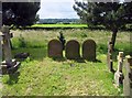
St Remigius, Roydon, Norfolk - Churchyard
Image: © John Salmon
Taken: 13 Jun 2008
0.13 miles
2
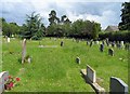
St Remigius, Roydon, Norfolk - Churchyard
Image: © John Salmon
Taken: 13 Jun 2008
0.15 miles
3
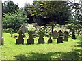
St Remigius, Roydon, Norfolk - Churchyard
Image: © John Salmon
Taken: 13 Jun 2008
0.19 miles
4
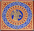
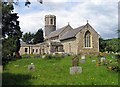
The church of St Remigius in Roydon - Victorian floor tiles
The church of St Remigius > http://www.geograph.org.uk/photo/1770044 has a round Norman tower with the top section and parapet added in Victorian times > http://www.geograph.org.uk/photo/1770049. Nave and arcade date from the 13th century, the chancel was added a century later. The elaborately carved pulpit > http://www.geograph.org.uk/photo/1770055 is Jacobean and has an hourglass stand attached to it. The church was extensively restored in the 19th century when the south aisle > http://www.geograph.org.uk/photo/1770062 was added. The stained glass > http://www.geograph.org.uk/photo/1770060 dates from that time. What now serves as a vestry on the south side of the chancel is the former medieval south porch.
Image: © Evelyn Simak
Taken: 23 Mar 2010
0.19 miles
6
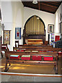
The church of St Remigius in Roydon - south aisle
The church of St Remigius > http://www.geograph.org.uk/photo/1770044 has a round Norman tower with the top section and parapet added in Victorian times > http://www.geograph.org.uk/photo/1770049. Nave and arcade date from the 13th century, the chancel was added a century later. The elaborately carved pulpit > http://www.geograph.org.uk/photo/1770055 is Jacobean and has an hourglass stand attached to it. The church was extensively restored in the 19th century when the south aisle was added. The stained glass > http://www.geograph.org.uk/photo/1770060 dates from that time. What now serves as a vestry on the south side of the chancel is the former medieval south porch.
Image: © Evelyn Simak
Taken: 23 Mar 2010
0.19 miles
7

St Remigius, Roydon: memorial on the south wall
Image: © Basher Eyre
Taken: 11 Aug 2010
0.19 miles
8
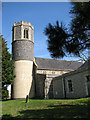
The church of St Remigius in Roydon - the Norman tower
For a full view of the church see > http://www.geograph.org.uk/photo/1770044.
Image: © Evelyn Simak
Taken: 23 Mar 2010
0.20 miles
9
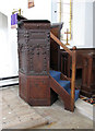
The church of St Remigius in Roydon - Jacobean pulpit
The church of St Remigius > http://www.geograph.org.uk/photo/1770044 has a round Norman tower with the top section and parapet added in Victorian times > http://www.geograph.org.uk/photo/1770049. Nave and arcade date from the 13th century, the chancel was added a century later. The elaborately carved pulpit is Jacobean and has an hourglass stand attached to it. The church was extensively restored in the 19th century when the south aisle > http://www.geograph.org.uk/photo/1770062 was added. The stained glass > http://www.geograph.org.uk/photo/1770060 dates from that time. What now serves as a vestry on the south side of the chancel is the former medieval south porch.
Image: © Evelyn Simak
Taken: 23 Mar 2010
0.20 miles
