IMAGES TAKEN NEAR TO
Hawk Crescent, DISS, IP22 4PQ
Introduction
This page details the photographs taken nearby to Hawk Crescent, IP22 4PQ by members of the Geograph project.
The Geograph project started in 2005 with the aim of publishing, organising and preserving representative images for every square kilometre of Great Britain, Ireland and the Isle of Man.

There are currently over 7.5m images from over14,400 individuals and you can help contribute to the project by visiting https://www.geograph.org.uk
Image Map
Images are licensed for reuse under creativecommons.org/licenses/by-sa/2.0
Notes
- Clicking on the map will re-center to the selected point.
- The higher the marker number, the further away the image location is from the centre of the postcode.
Image Listing (62 Images Found)
Images are licensed for reuse under creativecommons.org/licenses/by-sa/2.0
Image
Details
Distance
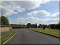
2
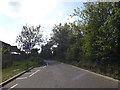
Frenze Hall Lane, Diss
This used to be a remote country road but now it forms the boundary to the urban expansion of Diss.
Image: © Adrian S Pye
Taken: 16 Apr 2015
0.07 miles
3

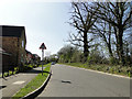
Frenze Hall Lane sign
On Frenze Hall Lane at the junction with Walcot Rise
Image: © Geographer
Taken: 16 May 2015
0.10 miles
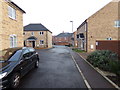
4

Walcot Rise sign
On Walcot Rise at the junction with Frenze Hall Lane
Image: © Geographer
Taken: 16 May 2015
0.10 miles
5
Frenze Hall Lane, Diss
At the junction with Walcot Rise
Image: © Geographer
Taken: 16 May 2015
0.10 miles
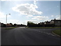
6
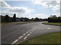
Walcot Rise, Diss
At the junction with Frenze Hall Lane
Image: © Geographer
Taken: 16 May 2015
0.11 miles
7

Walcot Rise, Diss
At the junction with Frenze Hall Lane
Image: © Geographer
Taken: 16 May 2015
0.11 miles
8
Walcot Rise, Diss
At the junction with Frenze Hall Lane
Image: © Geographer
Taken: 16 May 2015
0.11 miles
10
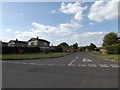
Frenze Hall Lane, Diss
At the junction with Walcot Rise
Image: © Geographer
Taken: 16 May 2015
0.11 miles