
IMAGES TAKEN NEAR TO
The Old Coaching Place, DISS, IP22 4NR
Introduction
This page details the photographs taken nearby to The Old Coaching Place, IP22 4NR by members of the Geograph project.
The Geograph project started in 2005 with the aim of publishing, organising and preserving representative images for every square kilometre of Great Britain, Ireland and the Isle of Man.

There are currently over 7.5m images from over14,400 individuals and you can help contribute to the project by visiting https://www.geograph.org.uk
Image Map
Images are licensed for reuse under creativecommons.org/licenses/by-sa/2.0
Notes
- Clicking on the map will re-center to the selected point.
- The higher the marker number, the further away the image location is from the centre of the postcode.
Image Listing (61 Images Found)
Images are licensed for reuse under creativecommons.org/licenses/by-sa/2.0
Image
Details
Distance
1
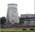
Button's Mill, Diss
Diss tower mill in Victoria Road (the mill was later known as Button's Mill) was built on common land by Thomas Jay in around 1817. The mill, situated beside the River Waveney, was six storeys high and one of the largest in the area. The tower measures 10 metres (33 feet) in diameter at the base and once had a domed cap with a ball finial. The cap held an 8 bladed fan and was vertically boarded to form its own petticoat. In 1928, during a heavy gale, one of the sails fell off and the opposing sail was removed not long afterwards in order to retain the balance. After a short time of running with just one pair of sails the mill finally ceased working in 1929. The mill appears to have been converted for domestic use.
Image: © Evelyn Simak
Taken: 31 Dec 2010
0.07 miles
2
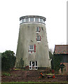
Button's Mill, Diss
Diss tower mill in Victoria Road (the mill was later known as Button's Mill) was built on common land by Thomas Jay in around 1817. The mill, situated beside the River Waveney, was six storeys high and one of the largest in the area. The tower measures 10 metres (33 feet) in diameter at the base and once had a domed cap with a ball finial. The cap held an 8 bladed fan and was vertically boarded to form its own petticoat. In 1928, during a heavy gale, one of the sails fell off and the opposing sail was removed not long afterwards in order to retain the balance. After a short time of running with just one pair of sails the mill finally ceased working in 1929. The mill appears to have been converted for domestic use.
Image: © Evelyn Simak
Taken: 31 Dec 2010
0.07 miles
4
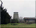
Converted windmill at Diss
Close to the River Waveney.
Image: © Adrian S Pye
Taken: 31 Dec 2010
0.09 miles
5
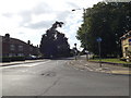
A1066 Victoria Road, Diss
At the junction with Vinces Road
Image: © Geographer
Taken: 16 May 2015
0.11 miles
7
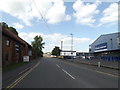
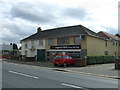
Vinces Road, Diss
At the junction with the A1066 Victoria Road
Image: © Geographer
Taken: 16 May 2015
0.13 miles
8
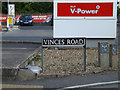
Vinces Road sign
On Vinces Road at the junction with the A1066 Victoria Road
Image: © Geographer
Taken: 16 May 2015
0.13 miles
9
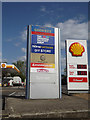
Signs on Vinces Road
At the junction with the A1066 Victoria Road
Image: © Geographer
Taken: 16 May 2015
0.13 miles
10
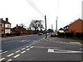
B1066 Victoria Road, Diss
At the junction with Victoria Close
Image: © Geographer
Taken: 2 Apr 2014
0.15 miles