
IMAGES TAKEN NEAR TO
Owen Road, DISS, IP22 4ER
Introduction
This page details the photographs taken nearby to Owen Road, IP22 4ER by members of the Geograph project.
The Geograph project started in 2005 with the aim of publishing, organising and preserving representative images for every square kilometre of Great Britain, Ireland and the Isle of Man.

There are currently over 7.5m images from over14,400 individuals and you can help contribute to the project by visiting https://www.geograph.org.uk
Image Map
Images are licensed for reuse under creativecommons.org/licenses/by-sa/2.0
Notes
- Clicking on the map will re-center to the selected point.
- The higher the marker number, the further away the image location is from the centre of the postcode.
Image Listing (155 Images Found)
Images are licensed for reuse under creativecommons.org/licenses/by-sa/2.0
Image
Details
Distance
1
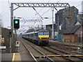
Train approaching Diss Station from the north
This train is operating one of the half-hourly services between Norwich and London Liverpool Street, which are the only services that serve Diss Station. To the right of the train can be seen the track of the freight loop that allows freight trains to be passed by faster passenger services if necessary. In front of the train can be seen the foot crossing used by station staff.
Image: © Glen Denny
Taken: 12 Mar 2011
0.06 miles
2
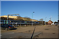
A train for Norwich leaving Diss
Viewed from the station car park.
Image: © Bill Boaden
Taken: 28 Dec 2013
0.06 miles
3
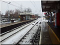
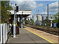
Diss station looking in the direction of Norwich
Image: © Helen Steed
Taken: 22 Jan 2013
0.07 miles
4
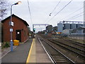
Looking northwards from Diss Station
This is the view looking northwards from the Norwich-bound platform at Diss Station. Just beyond the end of the platform is a foot crossing for use by railway staff. Beyond the two main lines is a loop line, with part of the station car park fenced off beyond it. The silos are used for grain storage and there are still railway sidings in place to serve the site.
Image: © Glen Denny
Taken: 12 Mar 2011
0.07 miles
5
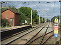
Railway towards Norwich
Looking north east from Diss Railway Station.
Image: © JThomas
Taken: 17 Sep 2015
0.07 miles
6
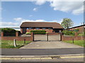
Kingdom Hall of the Jehovah's Witnesses
Off Gilray Road
Image: © Geographer
Taken: 16 May 2015
0.08 miles
8
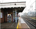
Diss railway station - the Down (Norwich-bound) platform
Diss railway station is on the Great Eastern Main Line and located about 32 kilometres (20 miles) south of Norwich. The station was once situated between Burston and Mellis stations but a number of stations between Diss and Norwich have since been shut. Diss is presently operated and served by National Express East Anglia and has the rare distinction of being served exclusively by Intercity trains. A local railway - Betts’ railway - was built in Victorian times to take produce to the station and bring back manure from the many London horses. It has long since been shut down and no traces appear to have remained of it.
The Great Eastern Railway grew in a rather piecemeal fashion from a number of smaller companies, and it did not complete its London terminus at London Liverpool Street until 1874. Historically, its routes served East Anglia, the East Coast and London’s north eastern suburbs, and this pattern is maintained today.
Image: © Evelyn Simak
Taken: 31 Dec 2010
0.09 miles
9
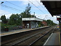
Diss Railway Station
Looking across to Platform 2 (trains for Norwich).
Image: © JThomas
Taken: 17 Sep 2015
0.09 miles
10
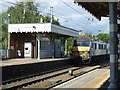
Diss Railway Station
Abellio Greater Anglia, Class 90, No. 90003 departing from Platform 2 for Norwich.
Image: © JThomas
Taken: 17 Sep 2015
0.09 miles