
IMAGES TAKEN NEAR TO
Wills Yard, DISS, IP22 4AP
Introduction
This page details the photographs taken nearby to Wills Yard, IP22 4AP by members of the Geograph project.
The Geograph project started in 2005 with the aim of publishing, organising and preserving representative images for every square kilometre of Great Britain, Ireland and the Isle of Man.

There are currently over 7.5m images from over14,400 individuals and you can help contribute to the project by visiting https://www.geograph.org.uk
Image Map
Images are licensed for reuse under creativecommons.org/licenses/by-sa/2.0
Notes
- Clicking on the map will re-center to the selected point.
- The higher the marker number, the further away the image location is from the centre of the postcode.
Image Listing (520 Images Found)
Images are licensed for reuse under creativecommons.org/licenses/by-sa/2.0
Image
Details
Distance
1
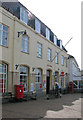
Diss - the Post Office on Market Place
For a wider view of this location see > http://www.geograph.org.uk/photo/1768244.
Diss is a market town situated on the northern bank of the river Waveney on the Norfolk/Suffolk border, the river forming the border between the two counties. The town has been known as Dice, Disce, Dysse and Dis since the time of the Domesday survey. The name is believed to originate from the Anglo-Saxon for a ditch, moat, dyke wall or earth or embankment, referring to the Mere the town has been built around. The town centre is largely unspoilt by new buildings > http://www.geograph.org.uk/photo/1768182 and although some of the larger retail companies have moved into the area they have managed to keep its character. Fine examples of period architecture including timber-framed buildings and Georgian and Edwardian facades as well as old courtyards lend character to the old market town which has been designated a conservation area. The Corn Hall > http://www.geograph.org.uk/photo/1768160 in the town centre is one of the most prestigious in South Norfolk and has the capacity to seat 400 people. It is used for concerts, meetings and exhibitions. 17th > http://www.geograph.org.uk/photo/1768253 and 18th century cottages can be found at Fair Green, one of the two old town centres, and many of the buildings in the town have tiled roofs. St Mary's Church > http://www.geograph.org.uk/photo/1768170 is situated above Mere Street, the shopping area. Diss has approximately 6,500 inhabitants and over 100 shops.
Image: © Evelyn Simak
Taken: 23 Mar 2010
0.01 miles
2
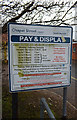
Chapel Street (Upper) Car Park sign
Off Chapel street
Image: © Geographer
Taken: 4 Feb 2017
0.02 miles
3
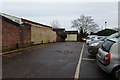
Chapel Street (Upper) Car Park
Off Chapel Street
Image: © Geographer
Taken: 4 Feb 2017
0.02 miles
4
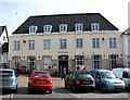
Diss - the Post Office on Market Place
Pictured here is the post office in Diss which is an elegant example of Neo-Georgian architecture dating from 1953 by architect Thomas Winterburn - the last in this style that had been popular since the Edwardian period, before the Post Office turned to modern architectural designs. [Above information was added on behalf of Edmund Bird who suggested it.]
Diss is a market town situated on the northern bank of the river Waveney on the Norfolk/Suffolk border, the river forming the border between the two counties. The town has been known as Dice, Disce, Dysse and Dis since the time of the Domesday survey. The name is believed to originate from the Anglo-Saxon for a ditch, moat, dyke wall or earth or embankment, referring to the Mere the town has been built around. The town centre is largely unspoilt by new buildings > http://www.geograph.org.uk/photo/1768182 and although some of the larger retail companies have moved into the area they have managed to keep its character. Fine examples of period architecture including timber-framed buildings and Georgian and Edwardian facades as well as old courtyards lend character to the old market town which has been designated a conservation area. The Corn Hall > http://www.geograph.org.uk/photo/1768160 in the town centre is one of the most prestigious in South Norfolk and has the capacity to seat 400 people. It is used for concerts, meetings and exhibitions. 17th > http://www.geograph.org.uk/photo/1768253 and 18th century cottages can be found at Fair Green, one of the two old town centres, and many of the buildings in the town have tiled roofs. St Mary's Church > http://www.geograph.org.uk/photo/1768170 is situated above Mere Street, the shopping area. Diss has approximately 6,500 inhabitants and over 100 shops.
Image: © Evelyn Simak
Taken: 23 Mar 2010
0.02 miles
7
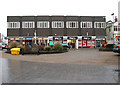
Shops in Mere Street, Diss
The market town of Diss is situated in the Waveney Valley. It was established around one of the deepest natural inland lakes in the country, the Mere > http://www.geograph.org.uk/photo/2214869.
Image: © Evelyn Simak
Taken: 31 Dec 2010
0.03 miles
9
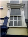
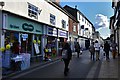
Hairdresser's Window
If you look very carefully, you can see the original writing on the window. I lived in that flat and only recently managed to decipher the text as "STYLING" as it was a barber's or hairdresser's years ago.
Image: © lpankhurst
Taken: 10 May 2007
0.04 miles
10
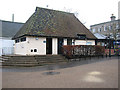
Public toilets in Mere Street, Diss
The market town of Diss is situated in the Waveney Valley. It was established around one of the deepest natural inland lakes in the country, the Mere > http://www.geograph.org.uk/photo/2214869.
Image: © Evelyn Simak
Taken: 31 Dec 2010
0.04 miles