
IMAGES TAKEN NEAR TO
Thetford Road, DISS, IP22 2SP
Introduction
This page details the photographs taken nearby to Thetford Road, IP22 2SP by members of the Geograph project.
The Geograph project started in 2005 with the aim of publishing, organising and preserving representative images for every square kilometre of Great Britain, Ireland and the Isle of Man.

There are currently over 7.5m images from over14,400 individuals and you can help contribute to the project by visiting https://www.geograph.org.uk
Image Map
Images are licensed for reuse under creativecommons.org/licenses/by-sa/2.0
Notes
- Clicking on the map will re-center to the selected point.
- The higher the marker number, the further away the image location is from the centre of the postcode.
Image Listing (16 Images Found)
Images are licensed for reuse under creativecommons.org/licenses/by-sa/2.0
Image
Details
Distance
1
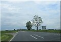
Off set minor roads from the A1066 east of Garboldisham
This area has history going back to Anglo-Saxons, Vikings and beyond. Mentioned in the Domesday Book and part of the estates of King William.
The road name seems to alter: when entering Garboldisham from the west it is Thetford Road; on leaving the village it is Diss Road; when entering the next village South Lopham it is Thetford Road; on leaving Diss Road. Let's just say it's the A1066.
Image: © Martin Dawes
Taken: 12 Jun 2024
0.02 miles
2
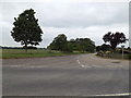
Smallworth Lane, Garboldisham
At the junction with the A1066 Thetford Road
Image: © Geographer
Taken: 23 Jun 2015
0.02 miles
3

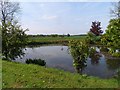
Private No Fishing
Private no fishing sign in the pond on the north side of the A.1066 near to Garboldisham, Norfolk. For view of the pond see http://www.geograph.org.uk/photo/1686817
Image: © Keith Evans
Taken: 31 Jan 2010
0.02 miles
5
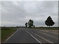
A1066 Thetford Road, Garboldisham
At the junction with Smallworth Lane
Image: © Geographer
Taken: 23 Jun 2015
0.02 miles
6

Pond
Pond on the north side of the A.1066 near to Garboldisham, Norfolk. See http://www.geograph.org.uk/photo/1690286 for other photo.
Image: © Keith Evans
Taken: 31 Jan 2010
0.03 miles
7
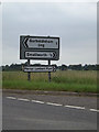
Roadsigns on the A1066 Thetford Road
At the junction with Smallworth Lane
Image: © Geographer
Taken: 23 Jun 2015
0.03 miles
8
Harrow Lane, Garboldisham
At the junction with the A1066 Theford Road
Image: © Geographer
Taken: 2 Jul 2016
0.03 miles
9
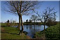
Pond near Garboldisham
This pond is situated on the north side of the A1066, east of Garboldisham, at the junction of Broadway Lane and Smallworth Lane.
Image: © Bob Jones
Taken: 2 Mar 2007
0.03 miles
10
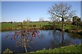
Pond near Garboldisham
Another view of Image], from the south.
Image: © Bob Jones
Taken: 2 Mar 2007
0.03 miles