1
Entrance to Garboldisham Hall
This track is no longer in use and the gates are firmly locked.
Image: © Bob Jones
Taken: 2 Mar 2007
0.07 miles
2
Harling Road, Garboldisham
Image: © David Howard
Taken: 7 Jul 2024
0.14 miles
3
B1111 Manor Road, Garboldisham
Image: © Geographer
Taken: 23 Jun 2015
0.15 miles
4
Cottages at Garboldisham
The north end of the village, at the junction of Broadway Lane and Harling Road.
Image: © Bob Jones
Taken: 2 Mar 2007
0.16 miles
5
Cottage in Water Lane
Image: © Evelyn Simak
Taken: 14 Feb 2010
0.20 miles
6
All Saints Garboldisham
The remains of All Saints Garboldisham, Norfolk for a bit more info see http://www.norfolkchurches.co.uk/garboldisham2/garboldisham2.htm and for other view see http://www.geograph.org.uk/photo/1684016
Image: © Keith Evans
Taken: 24 Jan 2010
0.21 miles
7
The ruined church of All Saints
Only part of the ivy-clad tower remains of All Saints church which was used until 1726. In 1734 licence was obtained to allow it to dilapidate. Font and seats were pulled up, the nave roof was unthatched, the roof of the south aisle unleaded, and both taken down. Four of the five bells were sold. The money obtained from the sale of the various items was used to repair St John's. The gravestones remained but only two can be found now near the north-eastern corner of the graveyard.
Image: © Evelyn Simak
Taken: 14 Feb 2010
0.21 miles
8
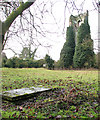
The ruined church of All Saints - two graves remain
Only part of the ivy-clad tower remains of All Saints church which was used until 1726. In 1734 licence was obtained to allow it to dilapidate. Font and seats were pulled up, the nave roof was unthatched, the roof of the south aisle unleaded, and both taken down. Four of the five bells were sold. The money obtained from the sale of the various items was used to repair St John's. The gravestones remained but only two can be found now near the north-eastern corner of the graveyard.
Image: © Evelyn Simak
Taken: 14 Feb 2010
0.21 miles
9
All Saints Garboldisham
The remains of All Saints Garboldisham, Norfolk for a bit more info see http://www.norfolkchurches.co.uk/garboldisham2/garboldisham2.htm and for other view see http://www.geograph.org.uk/photo/1675859
Image: © Keith Evans
Taken: 23 Jan 2010
0.21 miles
10
The ruined tower of All Saints church
Only part of the ivy-clad tower remains of All Saints church which was used until 1726. In 1734 licence was obtained to allow it to dilapidate. Font and seats were pulled up, the nave roof was unthatched, the roof of the south aisle unleaded, and both taken down. Four of the five bells were sold. The money obtained from the sale of the various items was used to repair St John's. The gravestones remained but only two can be found now near the north-eastern corner of the graveyard.
Image: © Evelyn Simak
Taken: 14 Feb 2010
0.21 miles


