IMAGES TAKEN NEAR TO
Back Street, DISS, IP22 2SD
Introduction
This page details the photographs taken nearby to Back Street, IP22 2SD by members of the Geograph project.
The Geograph project started in 2005 with the aim of publishing, organising and preserving representative images for every square kilometre of Great Britain, Ireland and the Isle of Man.

There are currently over 7.5m images from over14,400 individuals and you can help contribute to the project by visiting https://www.geograph.org.uk
Image Map
Images are licensed for reuse under creativecommons.org/licenses/by-sa/2.0
Notes
- Clicking on the map will re-center to the selected point.
- The higher the marker number, the further away the image location is from the centre of the postcode.
Image Listing (111 Images Found)
Images are licensed for reuse under creativecommons.org/licenses/by-sa/2.0
Image
Details
Distance
1
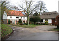
Water Lane
The west end of Water Lane Garboldisham, Norfolk.
Image: © Keith Evans
Taken: 23 Jan 2010
0.07 miles
2
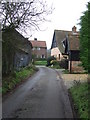
The ruined church of All Saints
Only part of the ivy-clad tower remains of All Saints church which was used until 1726. In 1734 licence was obtained to allow it to dilapidate. Font and seats were pulled up, the nave roof was unthatched, the roof of the south aisle unleaded, and both taken down. Four of the five bells were sold. The money obtained from the sale of the various items was used to repair St John's. The gravestones remained but only two can be found now near the north-eastern corner of the graveyard.
Image: © Evelyn Simak
Taken: 14 Feb 2010
0.08 miles
3
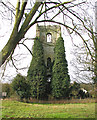
All Saints Garboldisham
The remains of All Saints Garboldisham, Norfolk for a bit more info see http://www.norfolkchurches.co.uk/garboldisham2/garboldisham2.htm and for other view see http://www.geograph.org.uk/photo/1675859
Image: © Keith Evans
Taken: 23 Jan 2010
0.08 miles
4
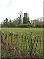
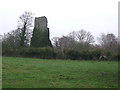
The ruined tower of All Saints church
Only part of the ivy-clad tower remains of All Saints church which was used until 1726. In 1734 licence was obtained to allow it to dilapidate. Font and seats were pulled up, the nave roof was unthatched, the roof of the south aisle unleaded, and both taken down. Four of the five bells were sold. The money obtained from the sale of the various items was used to repair St John's. The gravestones remained but only two can be found now near the north-eastern corner of the graveyard.
Image: © Evelyn Simak
Taken: 14 Feb 2010
0.08 miles
5
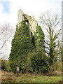
The ruined church of All Saints
Only part of the ivy-clad tower remains of All Saints church which was used until 1726. In 1734 licence was obtained to allow it to dilapidate. Font and seats were pulled up, the nave roof was unthatched, the roof of the south aisle unleaded, and both taken down. Four of the five bells were sold. The money obtained from the sale of the various items was used to repair St John's. The gravestones remained but only two can be found now near the north-eastern corner of the graveyard.
Image: © Evelyn Simak
Taken: 14 Feb 2010
0.08 miles
6
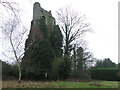
All Saints Garboldisham
The remains of All Saints Garboldisham, Norfolk for a bit more info see http://www.norfolkchurches.co.uk/garboldisham2/garboldisham2.htm and for other view see http://www.geograph.org.uk/photo/1684016
Image: © Keith Evans
Taken: 24 Jan 2010
0.08 miles
8
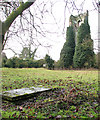
The ruined church of All Saints - two graves remain
Only part of the ivy-clad tower remains of All Saints church which was used until 1726. In 1734 licence was obtained to allow it to dilapidate. Font and seats were pulled up, the nave roof was unthatched, the roof of the south aisle unleaded, and both taken down. Four of the five bells were sold. The money obtained from the sale of the various items was used to repair St John's. The gravestones remained but only two can be found now near the north-eastern corner of the graveyard.
Image: © Evelyn Simak
Taken: 14 Feb 2010
0.08 miles
9

Weather Vane
Weather vane Garboldisham, Norfolk
Image: © Keith Evans
Taken: 23 Jan 2010
0.09 miles