
IMAGES TAKEN NEAR TO
Nethergate Street, DISS, IP22 2RA
Introduction
This page details the photographs taken nearby to Nethergate Street, IP22 2RA by members of the Geograph project.
The Geograph project started in 2005 with the aim of publishing, organising and preserving representative images for every square kilometre of Great Britain, Ireland and the Isle of Man.

There are currently over 7.5m images from over14,400 individuals and you can help contribute to the project by visiting https://www.geograph.org.uk
Image Map
Images are licensed for reuse under creativecommons.org/licenses/by-sa/2.0
Notes
- Clicking on the map will re-center to the selected point.
- The higher the marker number, the further away the image location is from the centre of the postcode.
Image Listing (146 Images Found)
Images are licensed for reuse under creativecommons.org/licenses/by-sa/2.0
Image
Details
Distance
1
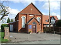
Hopton Methodist Church
Hopton Methodist church Hopton, Suffolk.
Image: © Keith Evans
Taken: 29 Mar 2009
0.04 miles
2
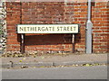
Nethergate Street sign
On the C636 Nethergate Street at the junction with the B1111 High Street, B1111 Bury Road, & C637 Thelnetham Road
Image: © Geographer
Taken: 5 Jul 2016
0.07 miles
3
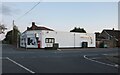
Bury Road at the end of Nethergate Road
Image: © David Howard
Taken: 2 Oct 2022
0.07 miles
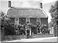
5
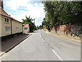
C636 Nethergate Street, Hopton
At the junction with the B1111 Bury Road, B1111 High Street & C637 Thelnetham Road
Image: © Geographer
Taken: 5 Jul 2016
0.07 miles
6
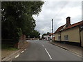
C636 Nethergate Street, Hopton
At the junction with the B1111 High Street, B1111 Bury Road & C637 Thelnetham Road
Image: © Geographer
Taken: 12 Jul 2016
0.07 miles
7
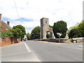
B1111 High Street, Hopton
At the junction with the B1111 Bury Road, C636 Netergate Street & C637 Thelnetham Road
Image: © Geographer
Taken: 5 Jul 2016
0.07 miles
8
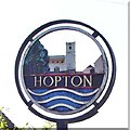
Hopton All Saints village sign (detail north face)
The church of All Saints and the River Little Ouse are represented on this side. The agricultural heritage is represented on the other side by oak leaves, wheat-sheaf, a plough and a pottery jug representing the mediaeval pottery kilns once thriving in the parish. https://www.geograph.org.uk/photo/6764281 https://www.geograph.org.uk/photo/4292884
Image: © Adrian S Pye
Taken: 15 Apr 2007
0.08 miles
9
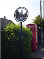
Hopton (Suffolk) village sign
The church of All Saints and the River Little Ouse are represented on side ‘a’ https://www.geograph.org.uk/photo/6764296 . The agricultural heritage is represented on side ‘b’ https://www.geograph.org.uk/photo/6764281 by oak leaves, wheatsheaf, a plough and a pottery jug.
Image: © Adrian S Pye
Taken: 15 Apr 2007
0.08 miles
10
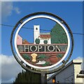
Hopton All Saints village sign (detail south face)
The church shows above the name. The agricultural heritage is represented on this side by oak leaves, wheat-sheaf, a plough and a pottery jug representing the mediaeval pottery kilns once thriving in the parish. The church of All Saints and the River Little Ouse are represented on the other side. https://www.geograph.org.uk/photo/4292884
Image: © Adrian S Pye
Taken: 26 Feb 2021
0.08 miles