
IMAGES TAKEN NEAR TO
Beech Croft, DISS, IP22 2LG
Introduction
This page details the photographs taken nearby to Beech Croft, IP22 2LG by members of the Geograph project.
The Geograph project started in 2005 with the aim of publishing, organising and preserving representative images for every square kilometre of Great Britain, Ireland and the Isle of Man.

There are currently over 7.5m images from over14,400 individuals and you can help contribute to the project by visiting https://www.geograph.org.uk
Image Map
Images are licensed for reuse under creativecommons.org/licenses/by-sa/2.0
Notes
- Clicking on the map will re-center to the selected point.
- The higher the marker number, the further away the image location is from the centre of the postcode.
Image Listing (95 Images Found)
Images are licensed for reuse under creativecommons.org/licenses/by-sa/2.0
Image
Details
Distance


3
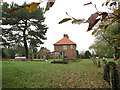
Cottages north of St Andrew's church
For a view of the church see > http://www.geograph.org.uk/photo/1576432.
Image: © Evelyn Simak
Taken: 10 Nov 2009
0.06 miles
4
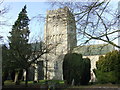
St Andrew South Lopham
The church of St Andrew South Lopham, Norfolk for more info see http://www.norfolkchurches.co.uk/lophamsouth/lophamsouth.htm
Image: © Keith Evans
Taken: 31 Jan 2010
0.06 miles
5
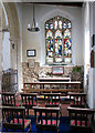
St Andrew's church - the lady chapel
The earliest part of St Andrew's church > http://www.geograph.org.uk/photo/1576432 - http://www.geograph.org.uk/photo/1576456 is Saxon and the little round window near the north-west corner of the building, high up on the wall, dates from this time. The magnificent tower - it is 20 metres high and the largest Norman church tower in East Anglia - was completed around 1120, in Norman times. It is believed that it was probably built by William Bigod, Earl of Norfolk, who gave the church into the care of the Monks of Thetford Priory. The chancel, as we see it today, was added in the 14th century > http://www.geograph.org.uk/photo/1576459. During the 15th century the nave roof was heightened and some the carved bench ends > http://www.geograph.org.uk/photo/1576468 under the tower date from this time. The stained glass window in the lady chapel commemorates Lopham's traditional industry of linen weaving. The C14 octagonal font > http://www.geograph.org.uk/photo/1576473 is decorated with carved tracery patterns. The font cover dates from the 17th century. South Lopham church is in fact dedicated to St Nicholas but has been known as St Andrew's church since 1829, when a history book mistakenly described it as such.
Image: © Evelyn Simak
Taken: 10 Nov 2009
0.06 miles
6
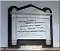
St Andrew's church - C20 memorial
The earliest part of St Andrew's church > http://www.geograph.org.uk/photo/1576432 - http://www.geograph.org.uk/photo/1576456 is Saxon and the little round window near the north-west corner of the building, high up on the wall, dates from this time. The magnificent tower - it is 20 metres high and the largest Norman church tower in East Anglia - was completed around 1120, in Norman times. It is believed that it was probably built by William Bigod, Earl of Norfolk, who gave the church into the care of the Monks of Thetford Priory. The chancel, as we see it today, was added in the 14th century > http://www.geograph.org.uk/photo/1576459. During the 15th century the nave roof was heightened and some the carved bench ends > http://www.geograph.org.uk/photo/1576468 under the tower date from this time. The stained glass window in the lady chapel > http://www.geograph.org.uk/photo/1576483 commemorates Lopham's traditional industry of linen weaving. The C14 octagonal font > http://www.geograph.org.uk/photo/1576473 is decorated with carved tracery patterns. The font cover dates from the 17th century. South Lopham church is in fact dedicated to St Nicholas but has been known as St Andrew's church since 1829, when a history book mistakenly described it as such.
Image: © Evelyn Simak
Taken: 10 Nov 2009
0.06 miles
7
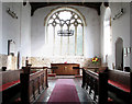
St Andrew's church - C14 chancel
The earliest part of St Andrew's church > http://www.geograph.org.uk/photo/1576432 - http://www.geograph.org.uk/photo/1576456 is Saxon and the little round window near the north-west corner of the building, high up on the wall, dates from this time. The magnificent tower - it is 20 metres high and the largest Norman church tower in East Anglia - was completed around 1120, in Norman times. It is believed that it was probably built by William Bigod, Earl of Norfolk, who gave the church into the care of the Monks of Thetford Priory. The chancel, as we see it today, was added in the 14th century. During the 15th century the nave roof was heightened and some the carved bench ends > http://www.geograph.org.uk/photo/1576468 under the tower date from this time. The stained glass window in the lady chapel > http://www.geograph.org.uk/photo/1576483 commemorates Lopham's traditional industry of linen weaving. The C14 octagonal font > http://www.geograph.org.uk/photo/1576473 is decorated with carved tracery patterns. The font cover dates from the 17th century. South Lopham church is in fact dedicated to St Nicholas but has been known as St Andrew's church since 1829, when a history book mistakenly described it as such.
Image: © Evelyn Simak
Taken: 10 Nov 2009
0.06 miles
8
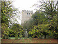
St Andrew's church
The earliest part of St Andrew's church > http://www.geograph.org.uk/photo/1576432 - http://www.geograph.org.uk/photo/1576456 is Saxon and the little round window near the north-west corner of the building, high up on the wall, dates from this time. The magnificent tower - it is 20 metres high and the largest Norman church tower in East Anglia - was completed around 1120, in Norman times. It is believed that it was probably built by William Bigod, Earl of Norfolk, who gave the church into the care of the Monks of Thetford Priory. The chancel, as we see it today, was added in the 14th century > http://www.geograph.org.uk/photo/1576459. During the 15th century the nave roof was heightened and some the carved bench ends > http://www.geograph.org.uk/photo/1576468 under the tower date from this time. The stained glass window in the lady chapel > http://www.geograph.org.uk/photo/1576483 commemorates Lopham's traditional industry of linen weaving. The C14 octagonal font > http://www.geograph.org.uk/photo/1576473 is decorated with carved tracery patterns. The font cover dates from the 17th century. South Lopham church is in fact dedicated to St Nicholas but has been known as St Andrew's church since 1829, when a history book mistakenly described it as such.
Image: © Evelyn Simak
Taken: 10 Nov 2009
0.07 miles
9
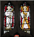
St Andrew's church - St Peter and St Andrew
The earliest part of St Andrew's church > http://www.geograph.org.uk/photo/1576432 - http://www.geograph.org.uk/photo/1576456 is Saxon and the little round window near the north-west corner of the building, high up on the wall, dates from this time. The magnificent tower - it is 20 metres high and the largest Norman church tower in East Anglia - was completed around 1120, in Norman times. It is believed that it was probably built by William Bigod, Earl of Norfolk, who gave the church into the care of the Monks of Thetford Priory. The chancel, as we see it today, was added in the 14th century > http://www.geograph.org.uk/photo/1576459. During the 15th century the nave roof was heightened and some the carved bench ends > http://www.geograph.org.uk/photo/1576468 under the tower date from this time. The stained glass window in the lady chapel > http://www.geograph.org.uk/photo/1576483 commemorates Lopham's traditional industry of linen weaving. The C14 octagonal font > http://www.geograph.org.uk/photo/1576473 is decorated with carved tracery patterns. The font cover dates from the 17th century. South Lopham church is in fact dedicated to St Nicholas but has been known as St Andrew's church since 1829, when a history book mistakenly described it as such.
Image: © Evelyn Simak
Taken: 10 Nov 2009
0.07 miles
10
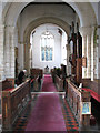
St Andrew's church - view west from the chancel
The earliest part of St Andrew's church > http://www.geograph.org.uk/photo/1576432 - http://www.geograph.org.uk/photo/1576456 is Saxon and the little round window near the north-west corner of the building, high up on the wall, dates from this time. The magnificent tower - it is 20 metres high and the largest Norman church tower in East Anglia - was completed around 1120, in Norman times. It is believed that it was probably built by William Bigod, Earl of Norfolk, who gave the church into the care of the Monks of Thetford Priory. The chancel, as we see it today, was added in the 14th century > http://www.geograph.org.uk/photo/1576459. During the 15th century the nave roof was heightened and some the carved bench ends > http://www.geograph.org.uk/photo/1576468 under the tower date from this time. The stained glass window in the lady chapel > http://www.geograph.org.uk/photo/1576483 commemorates Lopham's traditional industry of linen weaving. The C14 octagonal font > http://www.geograph.org.uk/photo/1576473 is decorated with carved tracery patterns. The font cover dates from the 17th century. South Lopham church is in fact dedicated to St Nicholas but has been known as St Andrew's church since 1829, when a history book mistakenly described it as such.
Image: © Evelyn Simak
Taken: 10 Nov 2009
0.07 miles