IMAGES TAKEN NEAR TO
Short Green, DISS, IP22 2EH
Introduction
This page details the photographs taken nearby to Short Green, IP22 2EH by members of the Geograph project.
The Geograph project started in 2005 with the aim of publishing, organising and preserving representative images for every square kilometre of Great Britain, Ireland and the Isle of Man.

There are currently over 7.5m images from over14,400 individuals and you can help contribute to the project by visiting https://www.geograph.org.uk
Image Map
Images are licensed for reuse under creativecommons.org/licenses/by-sa/2.0
Notes
- Clicking on the map will re-center to the selected point.
- The higher the marker number, the further away the image location is from the centre of the postcode.
Image Listing (38 Images Found)
Images are licensed for reuse under creativecommons.org/licenses/by-sa/2.0
Image
Details
Distance
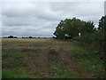
2
Green House Farm, Short Green
Off Dog Lane
Image: © Geographer
Taken: 21 Aug 2013
0.07 miles
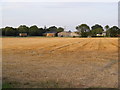
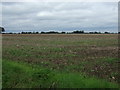
3
Farmland and hedgerow, Short Green
Off the B1077.
Image: © JThomas
Taken: 15 Sep 2015
0.07 miles
4
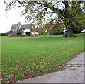
Short Green Farm in Short Green, Winfarthing
Image: © Evelyn Simak
Taken: 12 Nov 2010
0.08 miles
5
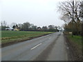
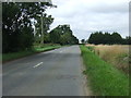
The B1077
Looking along the B1077 at Short Green, Norfolk.
Image: © Keith Evans
Taken: 7 Mar 2013
0.08 miles
8
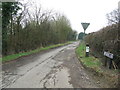
High London Lane
Looking along High London Lane at Short Street, Norfolk.
Image: © Keith Evans
Taken: 7 Mar 2013
0.13 miles
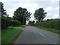
9
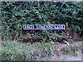
High London Lane sign
On High London Lane at the junction with the B1077 Short Green
Image: © Geographer
Taken: 28 Aug 2013
0.14 miles
10
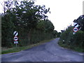
High London Lane, Winfarthing
At the junction with the B1077 Short Green
Image: © Geographer
Taken: 28 Aug 2013
0.14 miles