IMAGES TAKEN NEAR TO
The Drift, DISS, IP22 1DH
Introduction
This page details the photographs taken nearby to The Drift, IP22 1DH by members of the Geograph project.
The Geograph project started in 2005 with the aim of publishing, organising and preserving representative images for every square kilometre of Great Britain, Ireland and the Isle of Man.

There are currently over 7.5m images from over14,400 individuals and you can help contribute to the project by visiting https://www.geograph.org.uk
Image Map
Images are licensed for reuse under creativecommons.org/licenses/by-sa/2.0
Notes
- Clicking on the map will re-center to the selected point.
- The higher the marker number, the further away the image location is from the centre of the postcode.
Image Listing (86 Images Found)
Images are licensed for reuse under creativecommons.org/licenses/by-sa/2.0
Image
Details
Distance
1
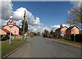
The Street, Botesdale
At the junction with Chapel Lane and The Drift near Parkview Chapel.
Image: © Geographer
Taken: 3 Mar 2015
0.06 miles
2
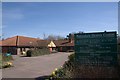
Botesdale Health Centre
The health centre provides an invaluable service Botesdale, Rickinghall and some forty surrounding parishes.
http://www.botesdalehc.co.uk/
Image: © Charles Greenhough
Taken: 11 Mar 2007
0.06 miles
3
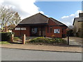
Parkview Chapel
Off The Street at the junction with Chapel Lane & The Drift
http://www.parkviewchapel.co.uk/
Image: © Geographer
Taken: 3 Mar 2015
0.06 miles
4
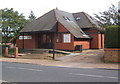
Parkview Chapel, Botesdale
An independent Evangelical church. According to the 1:25,000 map, both chapel and viewpoint are in the square.
Image: © Andrew Hill
Taken: 8 Sep 2008
0.06 miles
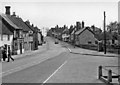
6
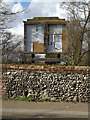
Botesdale Village Notice Board
At Botesdale Village Hall off The Street
Image: © Geographer
Taken: 3 Mar 2015
0.09 miles
8
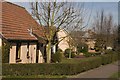
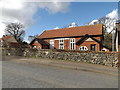
Back Hills, Botesdale
This development, exclusively of bungalows, was built in two phases between about 1987 and 1990 on the site of an old marl pit. The bungalows are built on concrete rafts which in turn rest on piles some twenty feet deep. They are handy for the local health centre Imageon the other side of the road.
Image: © Charles Greenhough
Taken: 11 Mar 2007
0.10 miles
9
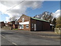
Former shop next to Botesdale Village Hall
Off Diss Road
Image: © Geographer
Taken: 3 Mar 2015
0.11 miles