IMAGES TAKEN NEAR TO
Mill Lane, DISS, IP21 5RR
Introduction
This page details the photographs taken nearby to Mill Lane, IP21 5RR by members of the Geograph project.
The Geograph project started in 2005 with the aim of publishing, organising and preserving representative images for every square kilometre of Great Britain, Ireland and the Isle of Man.

There are currently over 7.5m images from over14,400 individuals and you can help contribute to the project by visiting https://www.geograph.org.uk
Image Map
Images are licensed for reuse under creativecommons.org/licenses/by-sa/2.0
Notes
- Clicking on the map will re-center to the selected point.
- The higher the marker number, the further away the image location is from the centre of the postcode.
Image Listing (9 Images Found)
Images are licensed for reuse under creativecommons.org/licenses/by-sa/2.0
Image
Details
Distance
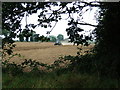
1
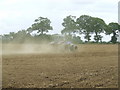
Working The Land
It may be Sunday but farm work has to go on as seen near to Weybread Suffolk.
Image: © Keith Evans
Taken: 9 Sep 2007
0.12 miles
4
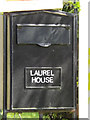
Laurel House Mailbox
At the entrance to Laurel House
Image: © Geographer
Taken: 21 Apr 2015
0.16 miles
5
Through The Trees
Working the land near to Weybread Suffolk.
Image: © Keith Evans
Taken: 9 Sep 2007
0.18 miles
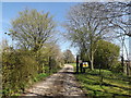
6
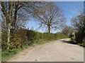
Footpath & entrance to Laurel House
Off Stubbing's Lane
Image: © Geographer
Taken: 21 Apr 2015
0.21 miles
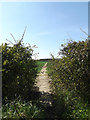
7
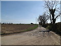
Stubbing's Lane, Weybread
Looking towards Mill Lane
Image: © Geographer
Taken: 21 Apr 2015
0.21 miles
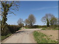
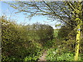
9
Footpath to the B1116 One Eyed Lane
Off Stubbing's Lane
Image: © Geographer
Taken: 21 Apr 2015
0.21 miles