IMAGES TAKEN NEAR TO
New Street, EYE, IP21 5JL
Introduction
This page details the photographs taken nearby to New Street, IP21 5JL by members of the Geograph project.
The Geograph project started in 2005 with the aim of publishing, organising and preserving representative images for every square kilometre of Great Britain, Ireland and the Isle of Man.

There are currently over 7.5m images from over14,400 individuals and you can help contribute to the project by visiting https://www.geograph.org.uk
Image Map
Images are licensed for reuse under creativecommons.org/licenses/by-sa/2.0
Notes
- Clicking on the map will re-center to the selected point.
- The higher the marker number, the further away the image location is from the centre of the postcode.
Image Listing (12 Images Found)
Images are licensed for reuse under creativecommons.org/licenses/by-sa/2.0
Image
Details
Distance
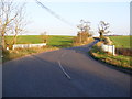
1
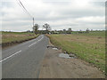
Valley Farm
Valley farm and fields from the road between Horham and Stradbroke
Image: © Jeff Tomlinson
Taken: 17 Jun 2007
0.03 miles
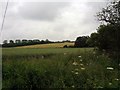
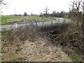
2
Fields beside the B1117 Stradbroke Road
Image: © Adrian S Pye
Taken: 1 Apr 2014
0.19 miles
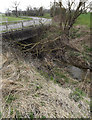
3
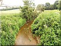
Brook running under the B1117
Looking towards Valley Farm.
Image: © Jeff Tomlinson
Taken: 17 Jun 2007
0.19 miles
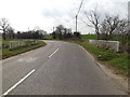
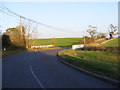
8
Bridge on the B1117 Stradbroke Road
Looking towards Stradbroke
Image: © Geographer
Taken: 15 Nov 2011
0.22 miles
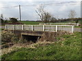
9
Bridge on the B1117 Stradbroke Road
Looking towards Stradbroke
Image: © Geographer
Taken: 15 Nov 2011
0.22 miles